We’ll meet again, don’t know where, don’t know when…
But we’ll meet again, and I’ll climb the stairs…
(Apologies to Ross Parker and Hugh Charles)
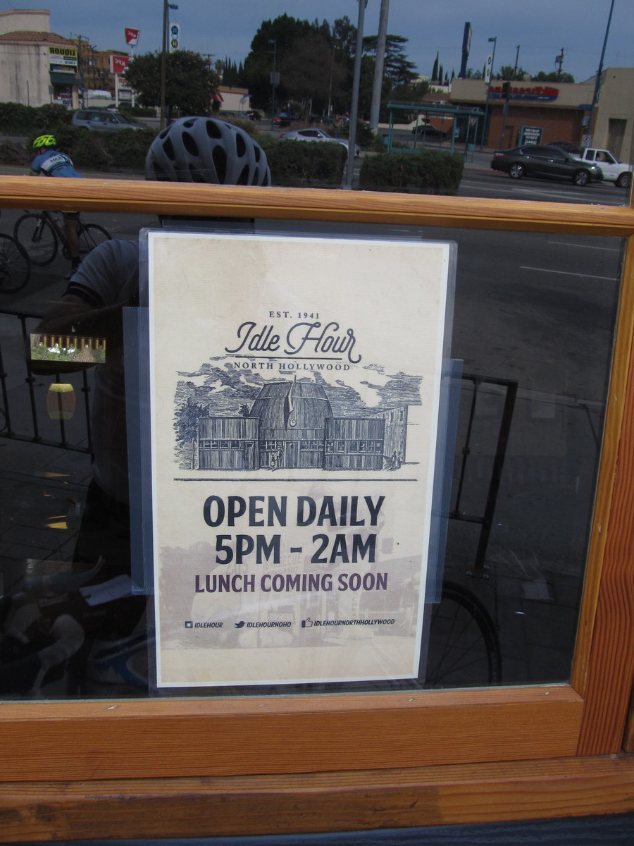
Tonight was the last practice at the Aon building in downtown Los Angeles. In past years, we had two practices a week for three months leading up to the race there next Saturday, but for some unknown reason, this year they only held six sessions. So most of us hardcore-nutball-stair-climbers were disappointed, but we still showed up. I’m still working on building my fitness back up after the troubles with my back last year, and other issues. Each time I came downtown, I’ve been doing five climbs. The practice course runs from 4 to 55, which is 51 floors, 1,186 steps, 690 feet, and 210 meters. So doing five climbs makes for a vertical kilometer. With my reduced speed this year, it’s an attainable goal, but just barely. The Vertical Mile is right out. Still, I’m making some progress.
The other times I came here for evening practice, my goal was always to do five climbs. The first one, I always aimed for my vertical mile pace of 4 1/2 floors per minute, which gets me to the top in about 11:15-11:20. Then for the subsequent climbs, I just tried to see how close I could stay to that pace, and it usually wasn’t all that close. By the fifth climb, I usually didn’t even bother timing it. But tonight, I was feeling a bit stronger, and I’d remembered to bring along a quart bottle of Gatorade.
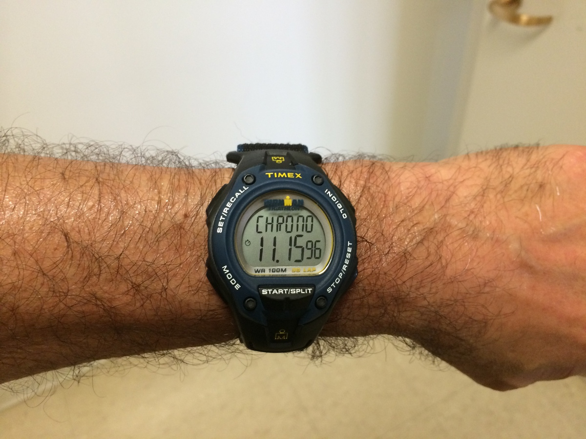
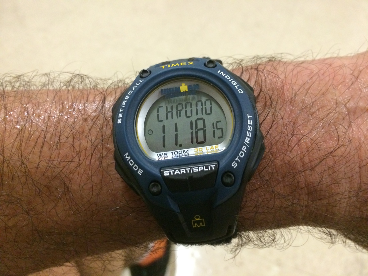
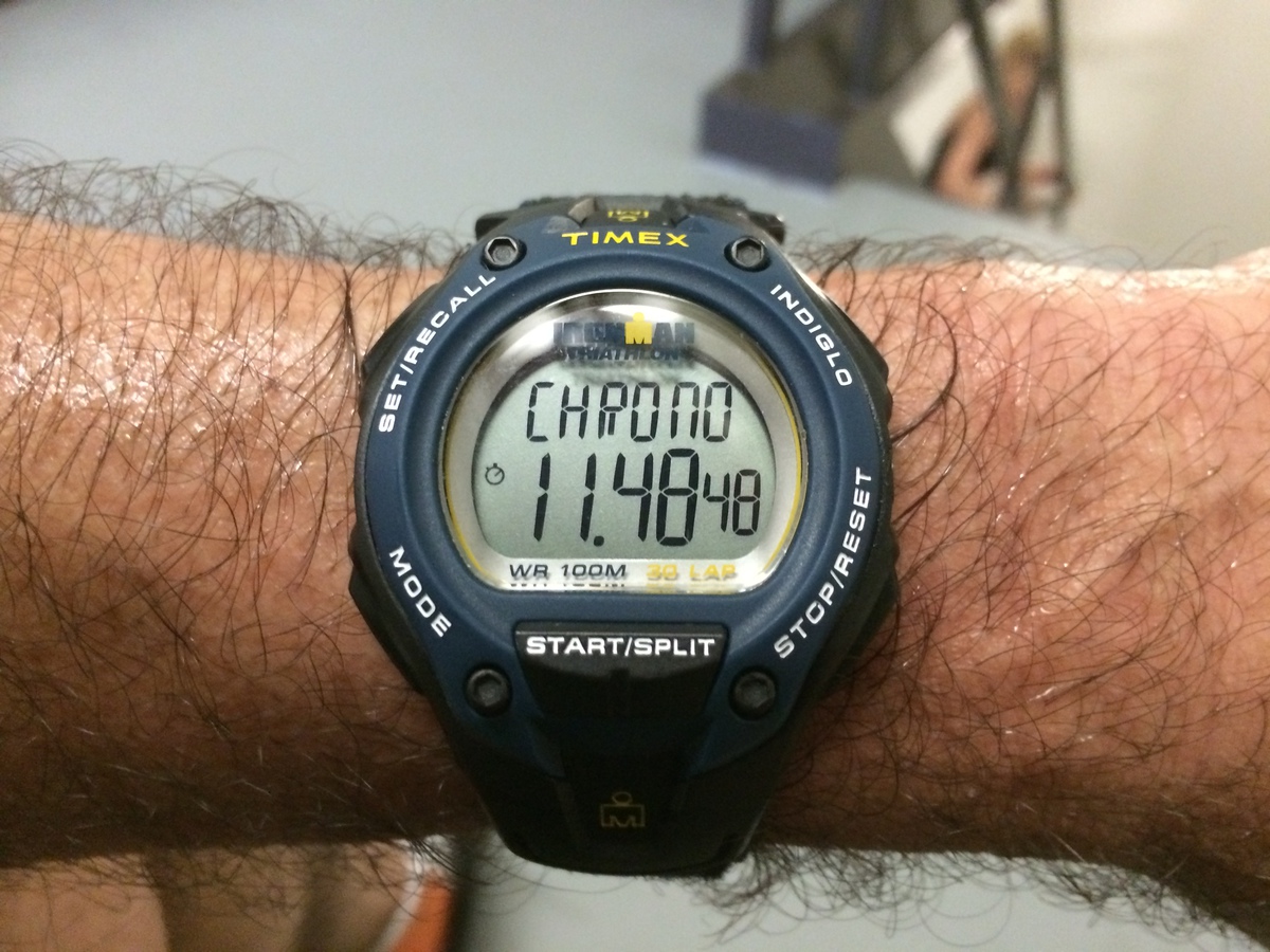
The first time up, I managed 11:16, which was right on target. The second time, I kept an eye on my watch for splits. At the mechanical floors on 22 and 42, I lost a few seconds going through the fire doors, but I still felt strong enough to dial the pace up for a few floors afterward to make up the time. And I came out at the top in 11:18, which I was pretty happy about. The third time up, I was starting to drag a bit. I was falling behind the pace by the 20th floor, so I just kept an eye on how far behind I was, with the idea that I just wanted to make the top in under 12 minutes. Having three climbs all under 12 minutes would be the fastest I’ve gone at this since last year, and I managed to make it to 55 in 11:48.
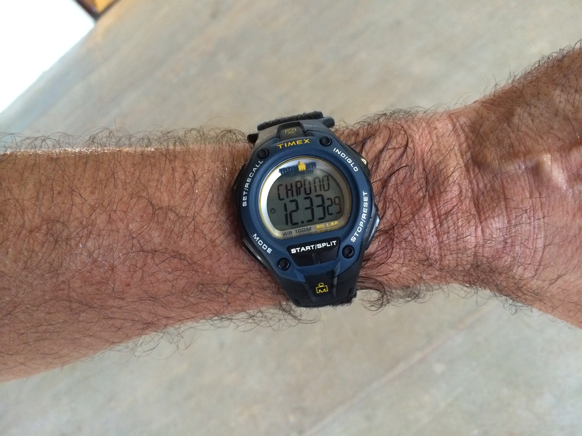
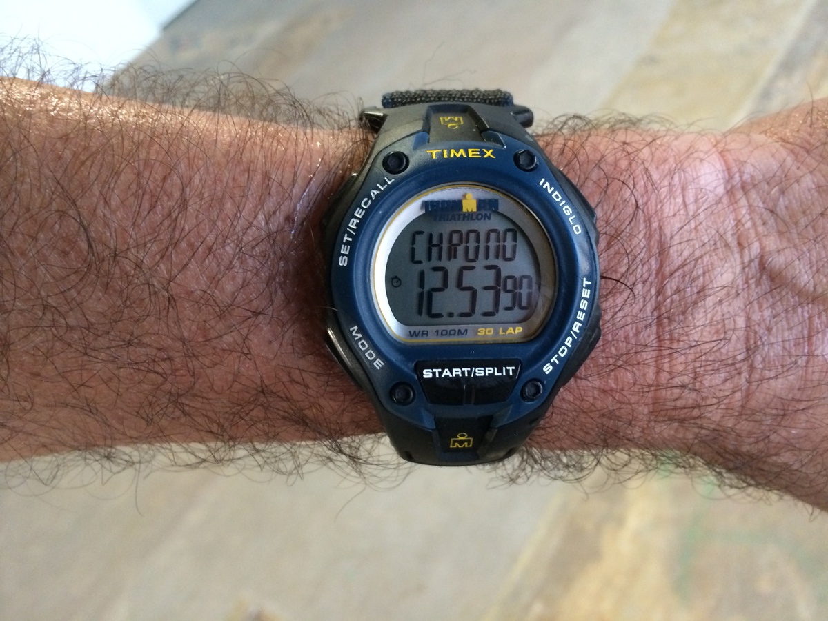
The fourth time up, I was really feeling it. I knew there was no chance of making it under 12, so my goal became to make it as close to 12 as I could. And 12:33 was still not bad, considering that the last few times I’ve done this, my fourth climb was in the 14-16 minute range. So with all that done, I went back down and got ready to do it a fifth time. This time, I started my watch, and my only goal was the make it in under 13 minutes. When I got to 45, I could see it was going to be close. But just knowing that when I got to the top, I could stop. So I was able to put on a burst of speed for the last four floors, and I came out on top at 12:54.
Overall, I was pretty happy with this evening. It’s the best I’ve done in a long time. But on the other hand, I still have a long way to go to get back to the level I was in 2013. For comparison, about a year and a half ago, I was able to do five consecutive 51-story climbs, averaging under 11 minutes each time. That’s not even a pipe dream now. But I’m going to keep plugging away at it. We have the Aon race a week from Saturday, and then the San Diego Towerthon in June.