Stan’s Obligatory Blog

9/27/2015

Update of the Spheres of MacArthur Park

Filed under: — stan @ 2:11 pm

A few weeks ago, we went out to see the “Spheres” art project under way in MacArthur Park. That weekend, they were in the process of installing the painted balls on the lake in the park. So this week we went to see the completed piece.

We took our usual route into downtown Los Angeles on Huntington Drive and Main St. There was a little haze in the air there, and that made for dramatic reflections off the windows of the Ritz Carlton near L.A. Live. We’ve seen this effect before, in 2013 and 2009. It’s always this time of the year, so I think the angle of the sun also is part of the effect.

Our snack stop was at Noah’s in Larchmont Village. We had bagels and drinks there. There was a little bakery a few doors down that we noticed for the first time today. I went in to see what it was like. But when they said everything was vegan and gluten-free that was a big NOPE for me.

The route back went on 7th St to MacArthur Park. That was where Carla got a flat. Fortunately, there was a nice shady spot to sit in and fix it. Then we got to the park. There were a lot more balls floating on the lake this time. It was very colorful.

It was getting pretty hot by now, so we deviated a bit from the route and headed directly up Benton Way to Silverlake. We took York across Highland Park to avoid the Colorado hill. And we stopped briefly at my office to get some ice from the freezer to ice our water bottles down for the last few miles home.

45 miles.

Route map and elevation profile

9/20/2015

Straight Outta Compton

Filed under: — stan @ 2:57 pm

Today’s bike club ride was another celebrity grave tour. Since we’ve all gone to see “Straight Outta Compton” and liked it, today’s ride was a visit to Rose Hills Cemetery in Whittier to visit the grave of Eric “Eazy-E” Wright. It was a nice day for riding when we set out in the morning.

We rode down to the Rio Hondo bike path, and took that all the way to Whittier Narrows. Carla told me that there had been a brushfire there recently, and sure enough, a large area down there was burned. It looked like the fire went through fast, since all the low brush was burned, but the trees had not burned. Still, it looked pretty bad there.

Heading east, we went over to Workman Mill Road and the main entrance to the cemetery. The guy in the information booth gave us directions on how to get there. It sounded simple enough. Just go up the main road and turn left at the sixth street. Little did we know that that meant a mile in and 500 feet up. Wow. That was a hard climb. But up there on the hill, we found Eric Wright. His grave is obviously visited a fair amount, judging by the grass around it. So he still has fans to this day, which I think is well-deserved. He did make a pretty big contribution to our culture. While we were up there, we also noticed another nearby grave which said that its owner’s favorite saying was, “That ain’t no hard hill to climb”. Which was funny, since it was a hard hill to climb to get up there. And also, because there’s a typo on his stone. D’oh.

Back at the bottom of the hill, we headed south in to Whittier, making a loop to get back to the San Gabriel River bike path. The plan was to take that all the way up to Irwindale. By then, it was starting to get hot. And the trail is uphill going that way. And we had a headwind. A hot headwind. By the time we got to Arrow Highway, we were all suffering, so we got off to go get some cold drinks. I found a Subway and got a big iced tea. Just drinking that cold liquid just felt so good. We stayed there for a while to cool off and rest. Then we decided to head home by the shortest route possible. The last part of the ride began to resemble the Retreat from Moscow. But we made it home all right. Which was good. Napoleon’s army had horses they could kill and eat, but we can’t do that with our bikes.

48 miles.

Route map and elevation profile.

9/19/2015

San Andreas Fault Scavenger Hunt with Atlas Obscura

Filed under: — stan @ 5:43 pm

Last November, Sue Hough took a group of us from the USGS office on a field trip to see some earthquake-related sights around the San Andreas Fault. I thought this was all very interesting, and I also thought that this could make a good Obscura Society event. I first talked to Erin about it in February, when we did the bar crawl in Los Feliz. I talked to Sue and she agreed to come along to narrate the tour. And after we worked out all the scheduling details, Field Agent Sandi was ready to put it all together. She arranged for a bus and driver, and I worked out the route and sights. We added three additional sights that were not on Sue’s original tour. This time, we were going to stop at the Lamont Odett Vista Point on the 14 freeway in Palmdale. This overlooks the fault, and we could see the trace of it stretching off into the distance in both directions. The second extra stop was to climb the small hill so we could get a better look at the famous road cut on the 14. And finally, we stopped at the Pallet Creek site where Kerry Sieh did his original trenching studies back in the ’70s. With all that in place, we were ready for the first Atlas Obscura San Andreas Fault Scavenger Hunt.

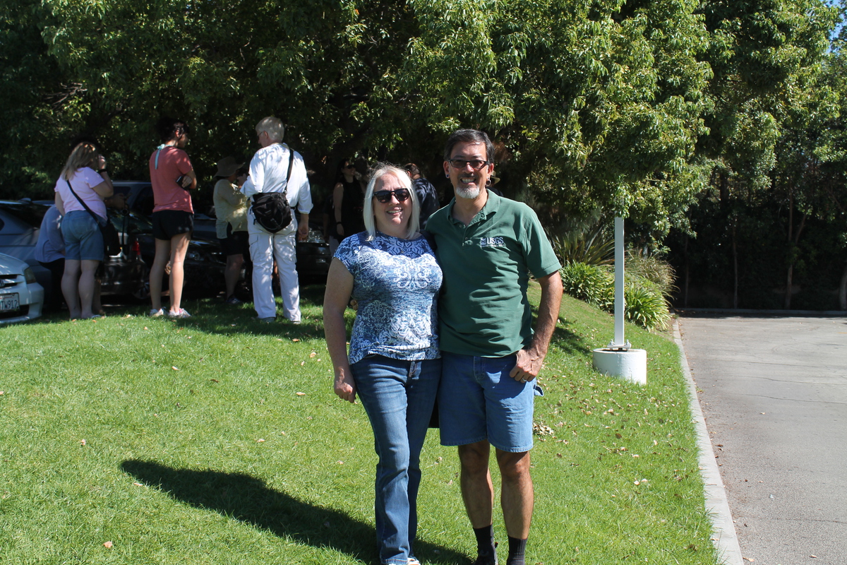
We started off at Caltech. This was partly because it’s fairly centrally-located and has available parking on weekends, and also so I could take the group on a short tour of the Seismo Lab before we left for the actual field trip. We started out at the downstairs exhibit, including a small piece of the Pallet Creek trench that is in display there. Then we headed upstairs to see the Media Center. I had some fact sheets and such to hand out, and I showed them a bit about the displays there. And on our way out, we stopped at the relief map on the wall in the hallway, and I showed them were we were going to go on the tour today. Then we headed down to the bus.

The first part of the tour was the relatively short ride to San Fernando to see the fault scarp next to the McDonald’s. On the way there, Sue entertained everyone with stories she found when writing her biography of Charles Richter. When we got there, she described to us how the scarp had formed in the 1971 earthquake. There was a guy on the tour who had spent some time back in 1971 traveling around and photographing the earthquake, and he had some good stories to tell.

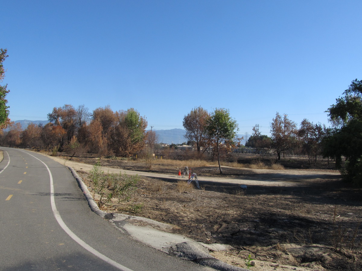
Then it was off to Palmdale. It’s kind of a long ride to get there, and we’d wanted to play a video about earthquakes on the bus, but the player didn’t work properly. It was having trouble reading the disc, and so the video was choppy. So we gave up on that, and Sue told us about more Richter-lore. When we got to Palmdale, we turned off at the Lamont Odett Vista Point off the 14 freeway. This overlooks Lake Palmdale and the California Aqueduct. And also the San Andreas Fault. The lake started out as a sag pond on the fault, and from there, we could see the trace of the fault stretching out as far as we could see in both directions.

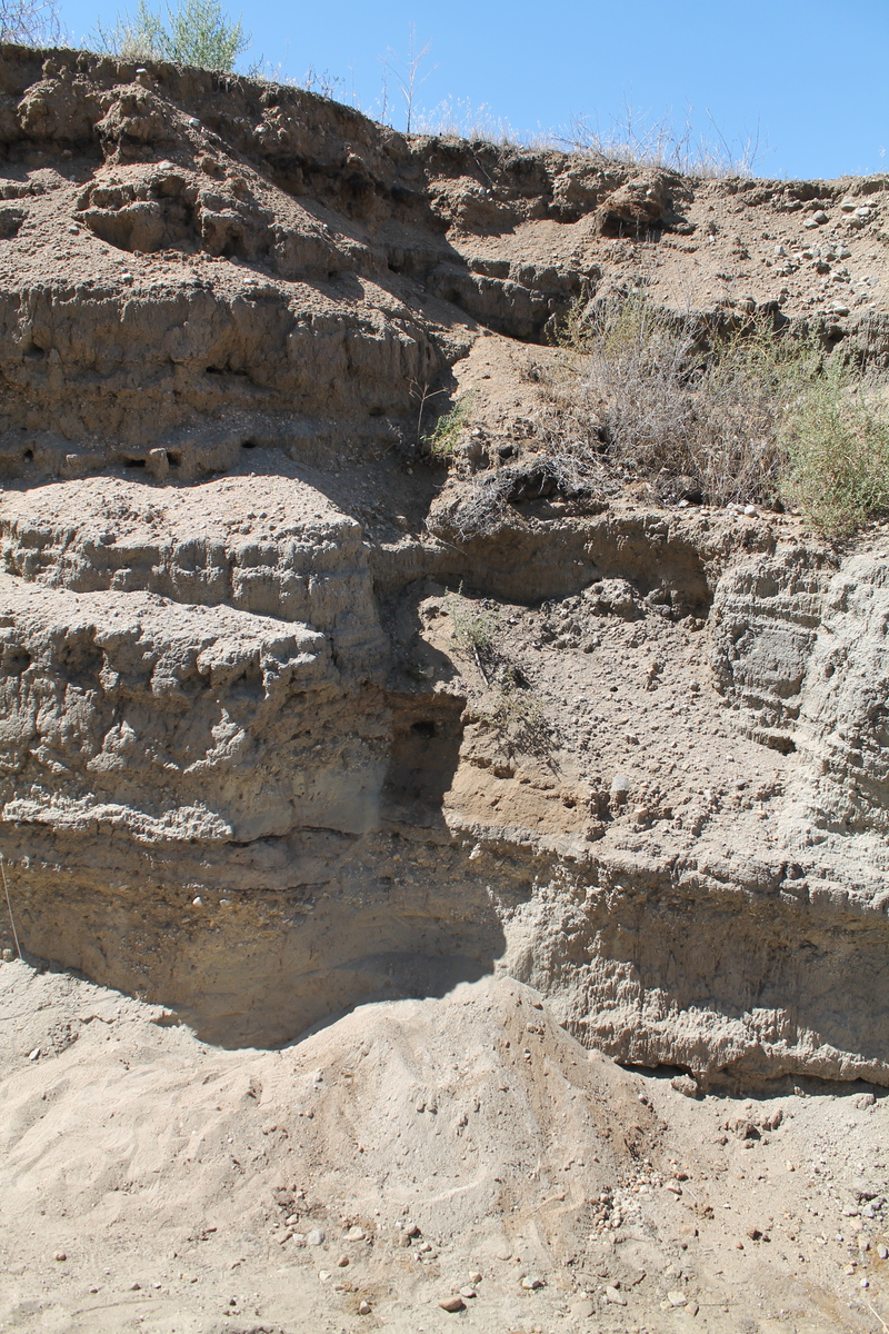
Next up was the famous road cut where the 14 freeway crosses the fault. The movement of the fault has pushed up a little hill, and in the process, it tortured the layers of rock in the hill. Then the freeway came along and blasted a cut through the hill, so we parked the bus and walked up one side of the hill so we could look down into the cut and admire the twisted rock layers.

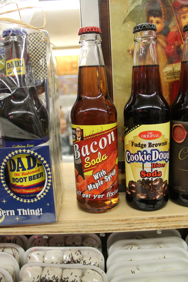
By now, it was lunchtime. Our lunch stop was at Charlie Brown Farms in Littlerock. This is a very odd place. They have bacon-flavored soda. And kangaroo meat. And dinosaurs outside. It was very strange, but entertaining. So we spent some time there having lunch before heading off for the rest of the tour.

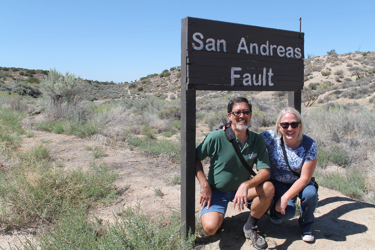
The next stop was only a few miles down the road. There is a spot on Pallet Creek Road where someone has put up a pair of signs to mark where the fault crosses the road. From there, again, we could see the trace of the fault stretching off into the distance as far as we could see in both directions. But mostly, it’s a photo-op to get our pictures with the sign marking the fault.

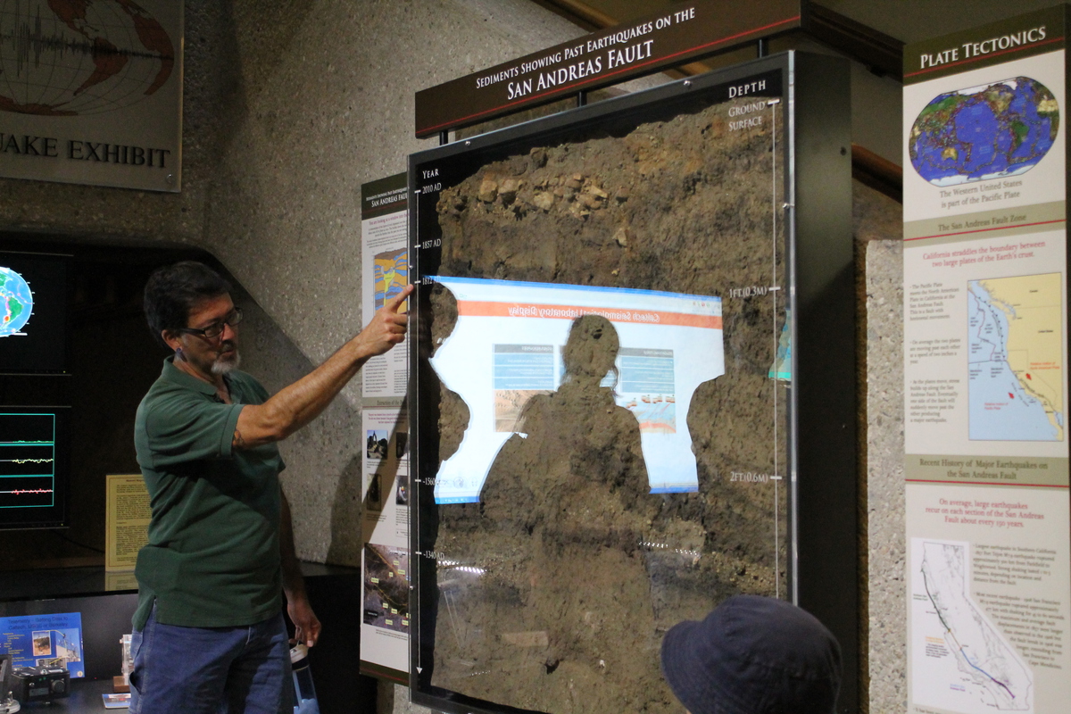
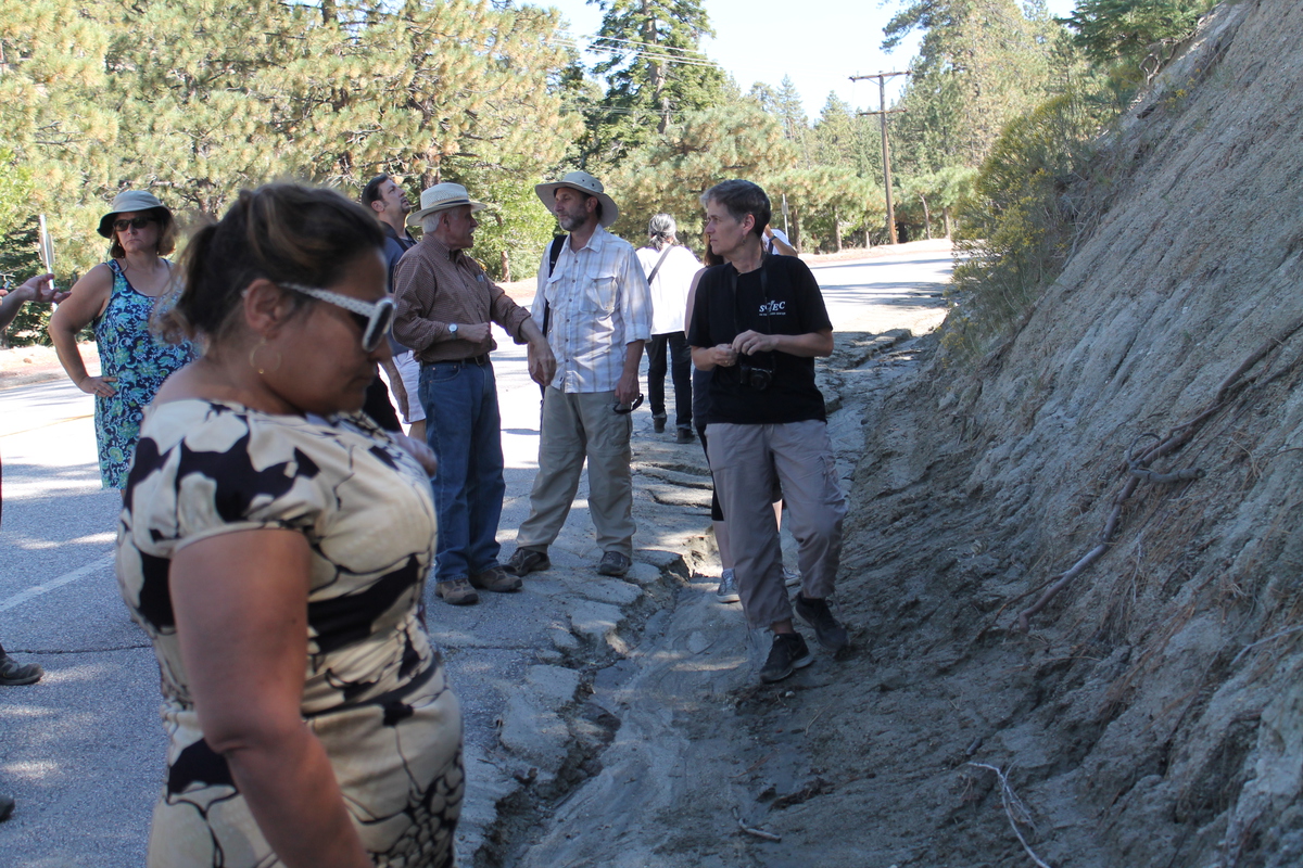
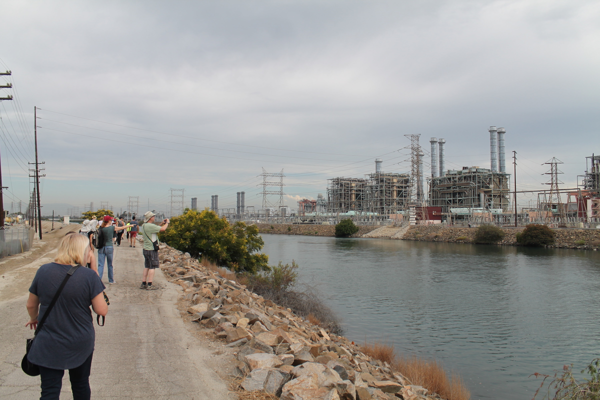
Just a short distance down the road was the actual Pallet Creek site where Kerry Sieh did his original trenching studies back in the ’70s. This was how he found evidence of large earthquakes prior to recorded history, and was able to estimate that they happen along that stretch of the fault about every 150 years, on average. Ken Hudnut from my office had recently brought a group up to see this site, and he’d prepared a poster to show them to explain what they were looking at, and he’d graciously given it to me to bring along today. So Sandi and I held the poster up, while Sue pointed out the features of the sediment layers, and in particular, the one spot in them where the layers were broken and offset. This marked the actual trace of the fault, and everyone had a chance to go and touch the spot and actually feel a little bit of the San Andreas Fault.

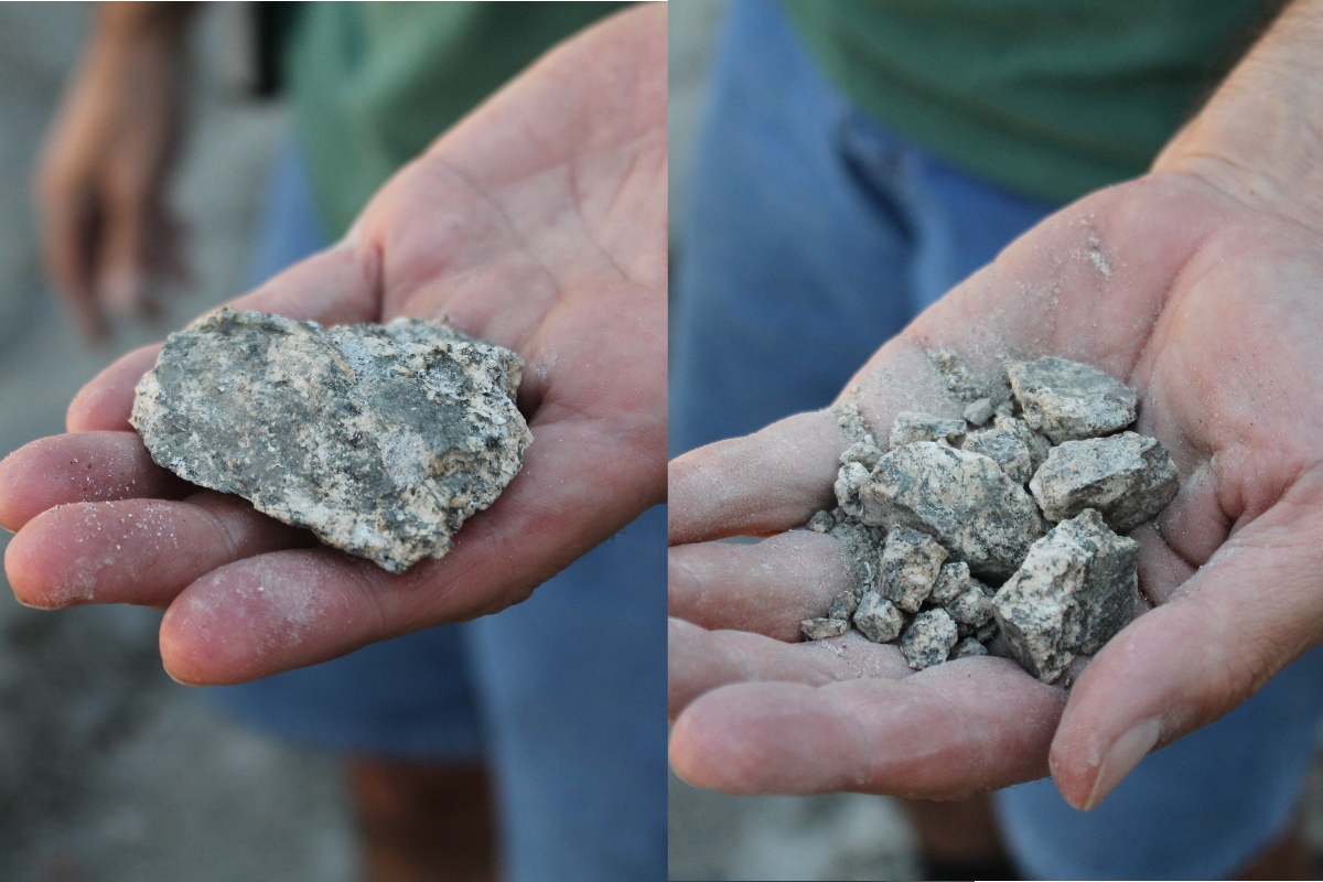
The next stop was a ways down the fault, and up into the mountains. The bus was working hard, climbing up the mountain road to Big Pines. This was a bit of a problem, since when the bus was working especially hard, it would automatically cut off the air conditioner. Coming up from the hot desert, this was a bit of a problem. But we finally made it up the the road cut up in the mountains where the cut went right through the fault, and one side of the cut was entirely sandy fault gouge. Sue showed us how it is basically ground-up rock, but we could dig in it and pull out chunks of rock. But since the rocks had been shattered by earthquakes, we could crush them in our hands. Everyone seemed to enjoy that. It’s not every day when you can take a chunk of granite and crush it in your hands.

From there, we continued on up the mountains and through Wrightwood. We went down the road down Lone Pine Canyon. That is the road that follows the trace of the fault, and it’s the way we went last time we did this tour. But since I was more involved and navigating this time, I realized just how scary a descent that is. The road down the canyon is many, many miles of 10% downgrade, and it was kind of intimidating. But our driver was good, and he got us down to the bottom just fine. We got on the 15 freeway for one exit, and then we got off to go visit Lost Lake.

Lost Lake is a little sag pond on the fault near Cajon Pass. It’s a very improbable thing. A little lake in the middle of the desert. No stream feeds it, and no stream drains it. The water is cold, and it just comes up out of the fault below. One thing I did notice, though. The water in the lake was quite a bit lower than it was last November when we visited. I guess it’s yet another casualty of the drought.

That brought us to the end our our tour. We got back on the bus for the trip back to Pasadena. It seemed that everyone liked it, and Sandi was talking about wanting to do it again. I’m game for that, although I’m not sure Sue was. But I think that’s all right. There are other scientists in the office who might be willing to do this, or, if it comes down to it, I can do the narration myself. So I think we may well do this tour again.

It was a fun day.

9/12/2015

Sea Turtle Trek with Atlas Obscura

Filed under: — stan @ 1:32 pm

Some years ago, I read that there is a colony of green sea turtles living in the San Gabriel River, near the power plant in Long Beach. The last time I went on the bike club ride to Seal Beach, I tried to look at the river there and see if I could see one, but I couldn’t spot any. So when I found out that Atlas Obscura was going on a tour of the Los Cerritos wetlands and to see the turtles by the power plant, I got us tickets right away.

We met at the entrance to the wetlands, right next to the San Gabriel River in Seal Beach. After a little introduction by our guides, we set off. It was about a mile of walking through the wetlands and around oil wells and such before we got to the power plant. The spot where we were going to look for turtles is right across the river from the power plant. But as we were crossing the bridge, someone spotted a turtle coming up to breathe right below us. Fortunately, I had my camera out and ready, and I snapped a few pictures before the turtle went back underwater. It looked like its shell was probably two or three feet long.

We continued on to the turtle-viewing area. Our guide spotted one turtle head coming up briefly when we got there, but the rest of the time we were there, we didn’t see any more turtles. On the way back, some people saw another turtle while we were crossing the bridge, but I didn’t see that one. So in the end, I only saw one turtle, but I did get a pretty good picture of it, so I can’t complain. This was still a pretty good adventure.


9/10/2015

Slog du jour

Filed under: — stan @ 9:27 pm

It’s Thursday, and time for another four slogs up the Wells Fargo building stairs. And yet again, I did four climbs, hoping to be able to do three at a steady pace, but I was only able to manage two. And the third and fourth times up were both just a miserable slog. But hey – It’s fun!

9/8/2015

Two out of three ain’t bad… I guess…

Filed under: — stan @ 9:23 pm

Due to some crap I’m having to deal with in regular life right now, I’m finding it extraordinarily hard to get motivated to climb the stairs. Well, that’s not entirely true. I can climb them. I just can’t find it in me to go very fast right now. So today was yet another slog up the Wells Fargo building. I was hoping I could do three at a steady pace, and then a fourth just to make it to the top. But as it turned out, I was only able to do two at my target pace, and then it kind of fell of a cliff. And yes, the fourth time was a slog, and I didn’t even bother to time it.

9/6/2015

Checking up on the Gold Line Extension again

Filed under: — stan @ 1:57 pm

Today’s bike club ride is the latest installment checking up on the progress of the Metro Gold Line extension out to Azusa. We’ve been going out to see this about every few months for the last two years, and it’s nearly finished. The last time we did this tour was in January, and there’s been a lot of progress since then.

Starting out, we rode Colorado across Arcadia to get the the nearly-finished Arcadia station. In fact, it looks finished. The monitors were all turned on, and it looked like it was ready for a train to pull in at any time. And of course the art for the station includes a peacock.

The Monrovia station looks nearly finished, but it is still fenced off, and there are still a lot of paving stones to be placed. The parking structure next to it looks done, though. We also stopped off to have a look at the operations center. Carla and I went there for the dedication and open house that Metro held back in May.

Continuing east, we stopped at the Duarte station. It also looks like it’s ready for a train to pull in. In fact, I did see a train there a few weeks ago when I rode out there for the dedication of the station.

Heading up the San Gabriel River bike trail, we turned off at the Azusa Rockery. We took a few minutes to look at the signs, and we finally found out just what it is that they’re mining there. Then we continued on to the Azusa downtown station. That was where Metro held the ‘Golden Spike‘ ceremony last year. It’s also where Carla and I saw how they weld the rails together with thermite. And while we were there, we met Oreo. She has a piece of cardboard to stand on, and she’s happy to ride around in the bike basket.

At the end of the line, we saw the Azusa APU/Citrus College station. That one looks the least finished of all the new stations. The station itself looks pretty finished, but the access to it is not done yet. It looks like there is going to be a street going through the underpass under the tracks, and that will be the access to the station, but it’s still a bit unclear if that will be a real street, or just a walkway of some sort.

We turned south in Glendora, and we headed back on Gladstone St. We took a side trip to see the Irwindale station. It looks pretty much done. It’s a far cry from how it looked the first time we did this tour.

Coming back, we rode to Monrovia and Merengue. Leaving there, we took the alley, where we saw the airplane mural on the wall of a building there. I guess there was some sort of vent built into the wall, and someone decided to put a propeller on it and then paint an airplane on the wall around it. It was a good little bit of street art.

39 miles

Route map and elevation profile

9/3/2015

Yup. More stairs…

Filed under: — stan @ 9:07 pm

I missed going to the stairs on Tuesday, since it was the day I had to turn in my brownies for the L.A. County Fair baking contest. So now it’s Thursday, and time to climb the building some more.

This time, I wanted to try something a little different. I was curious to see if I could maintain five floors per minute up the building. That used to be my ‘loafing’ pace, but these days, it’s about as fast as I can go for any distance. So I was curious to see if I could do it up the 54 floors at the Wells Fargo building. And as it turned out, I was able to do that just fine. But I didn’t think I could do that pace for the second time up. So I slowed down a bit and aimed for 12 minutes on the second climb. And I was able to do that. But the third and fourth times up the building were grim. I didn’t bother timing them, and I just sort of slogged up the stairs both times. Still, it was a good outing.

Powered by WordPress