Stan’s Obligatory Blog

4/30/2017

666

Filed under: — stan @ 3:51 pm

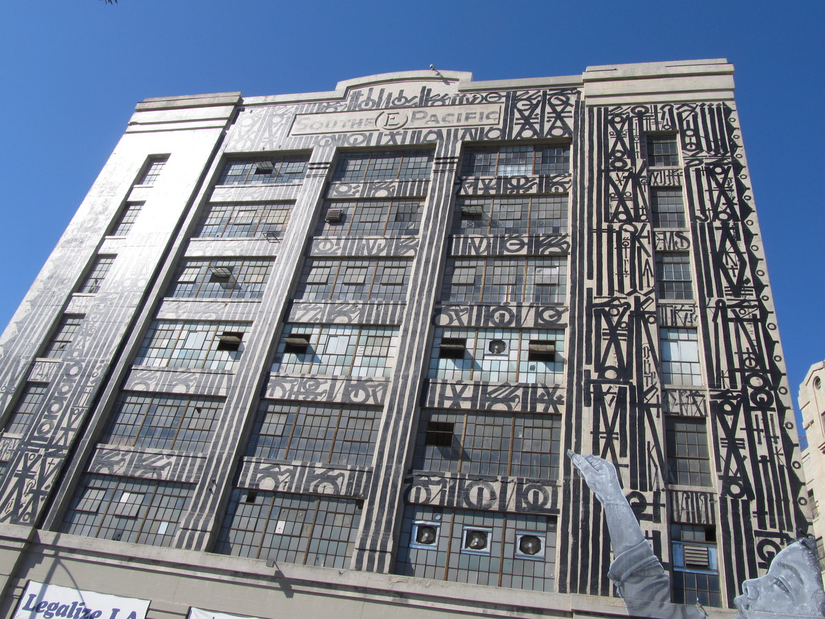
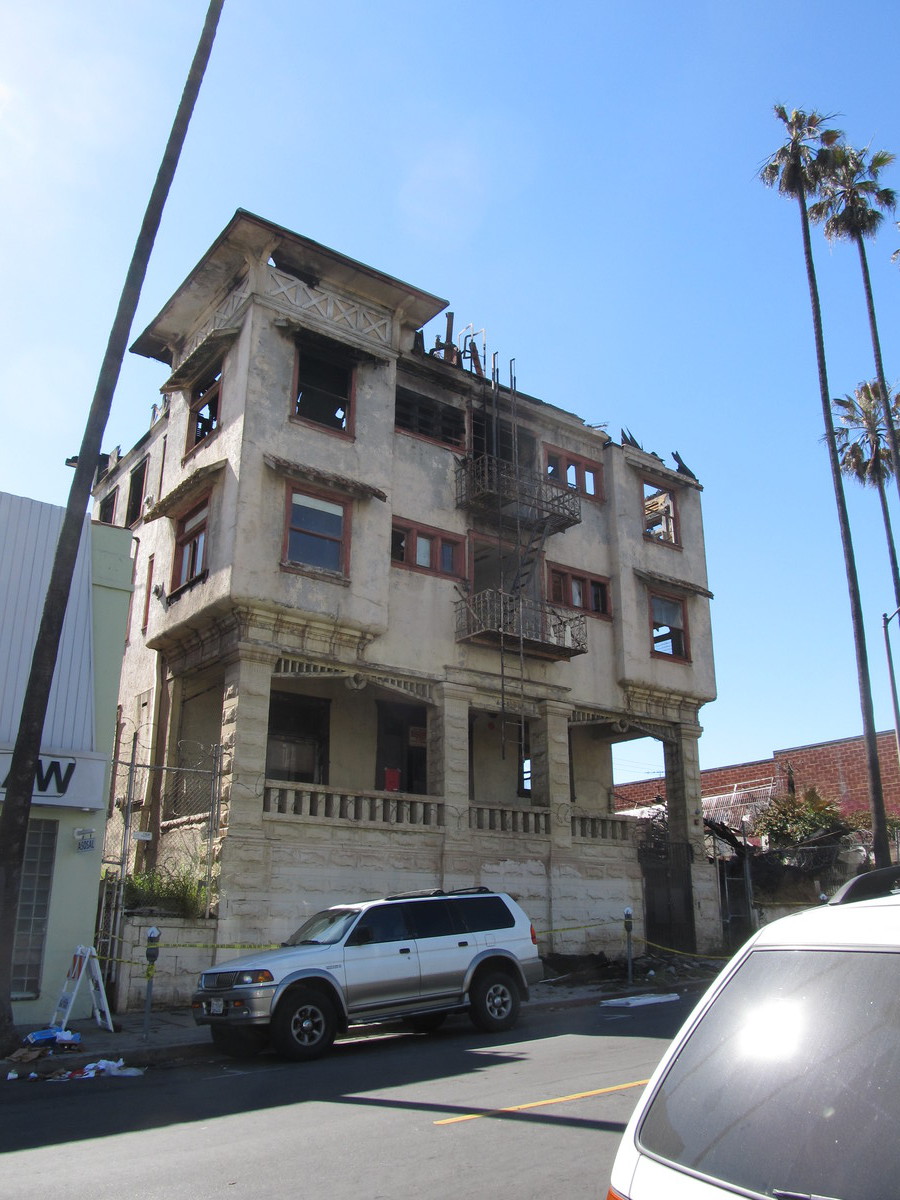
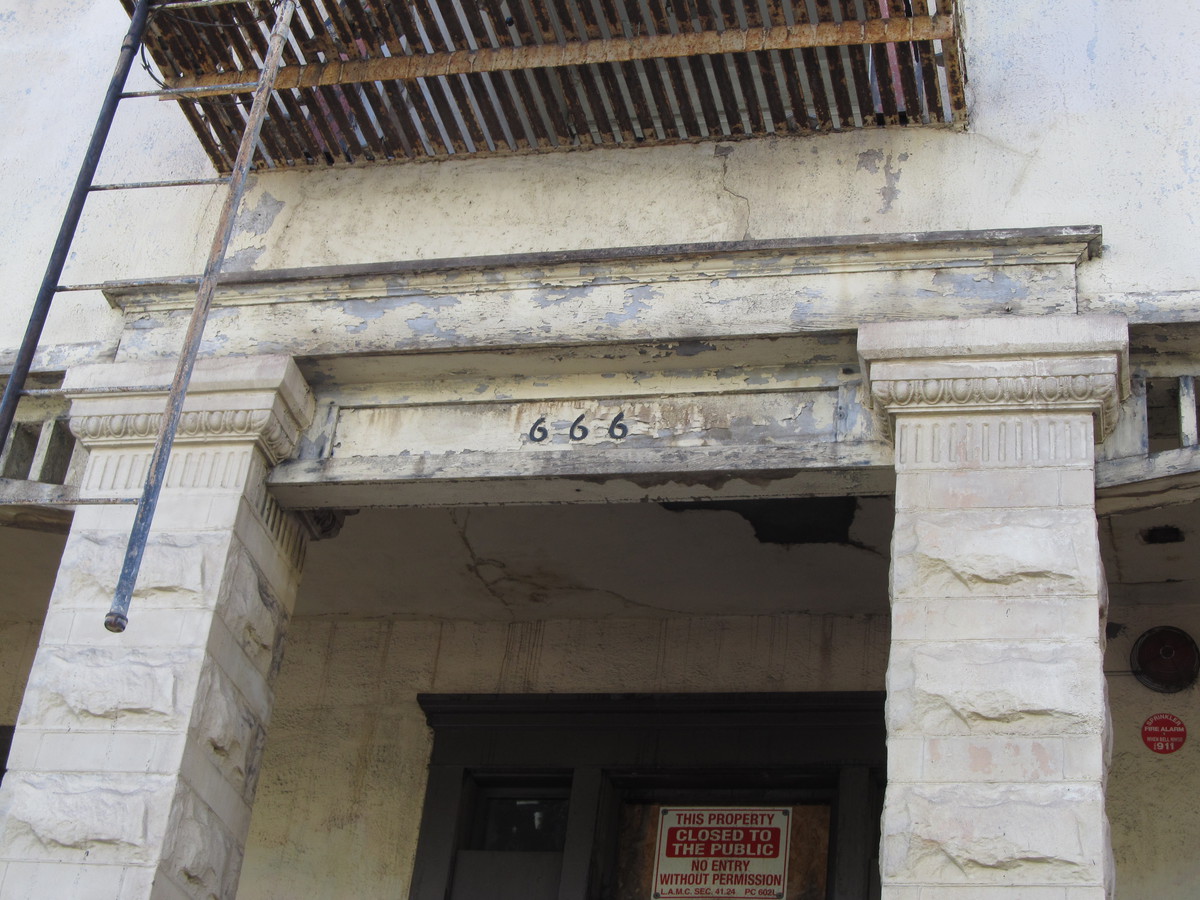
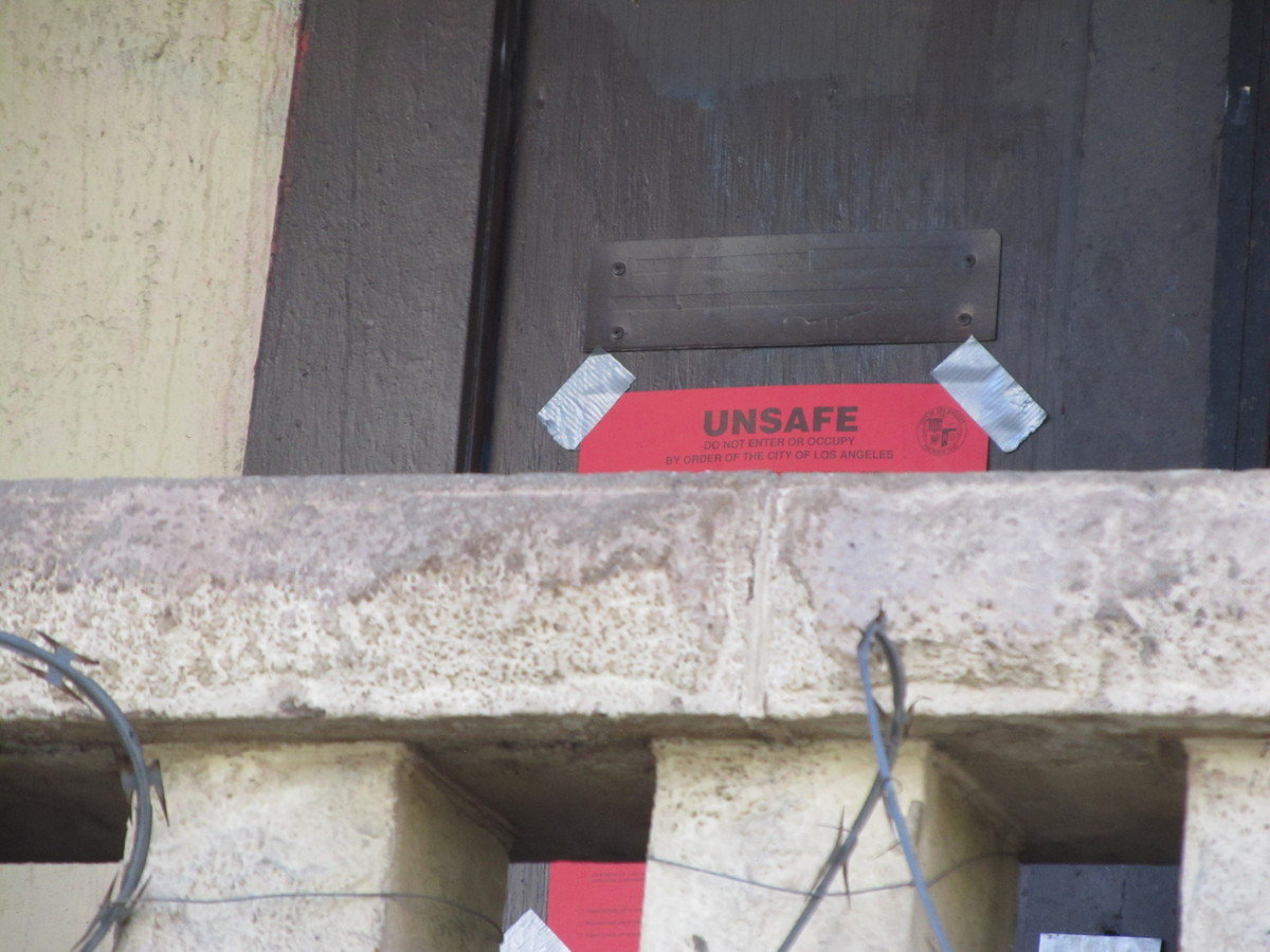
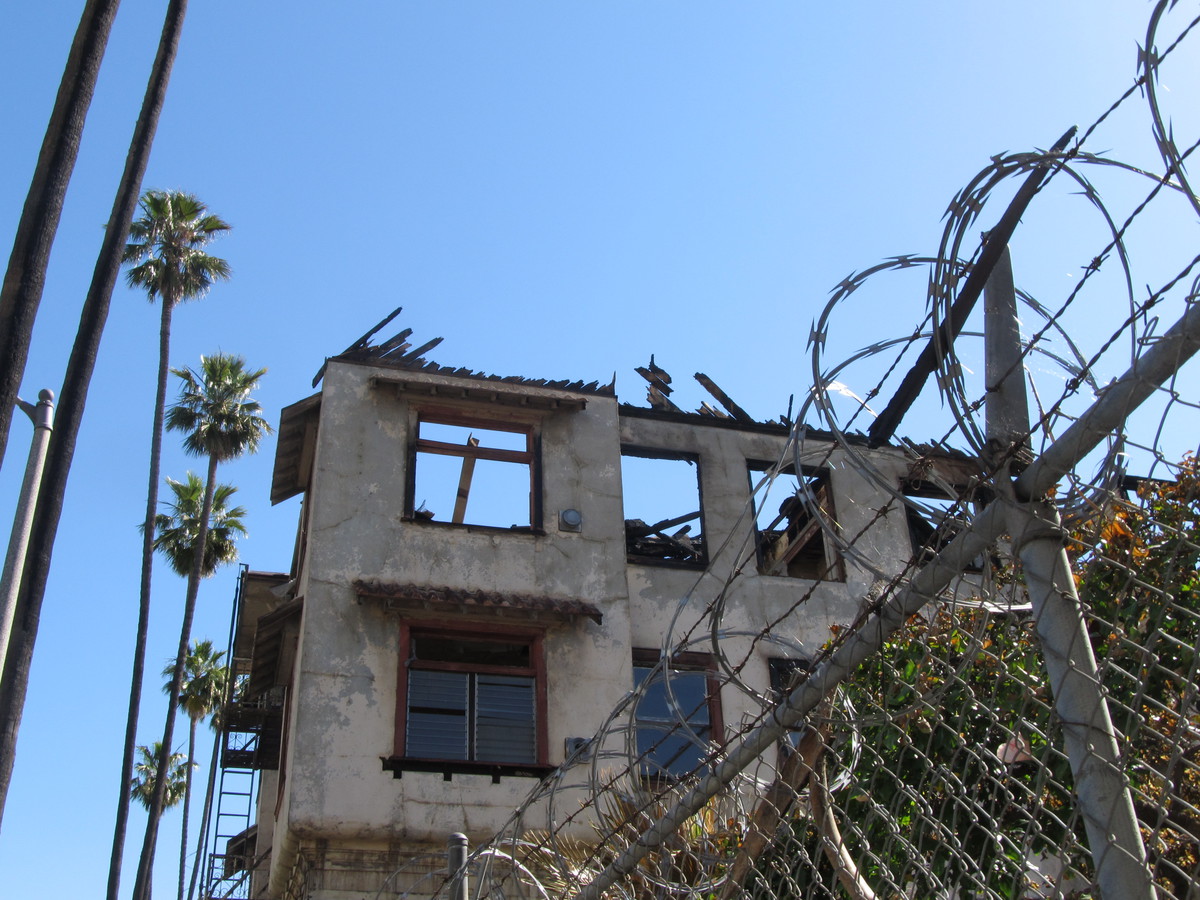
When we ride through Westlake and up to Echo Park, we usually go up Bonnie Brae St. And we always pass 666 Bonnie Brae, which is a building that seems completely appropriate to wear the number 666. And this week, we’d heard that the building next to it had burned down, so we went back to see how badly 666 had been damaged.

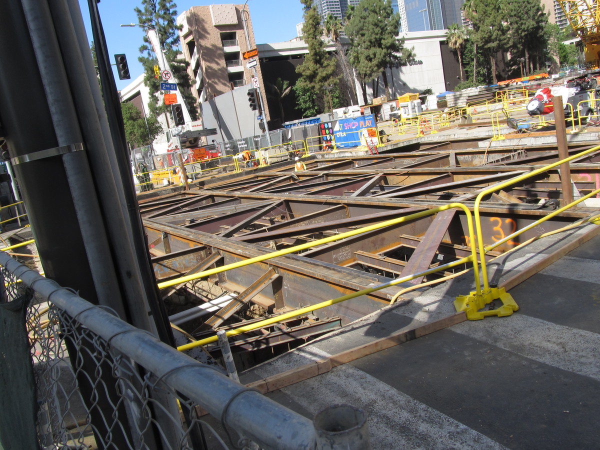
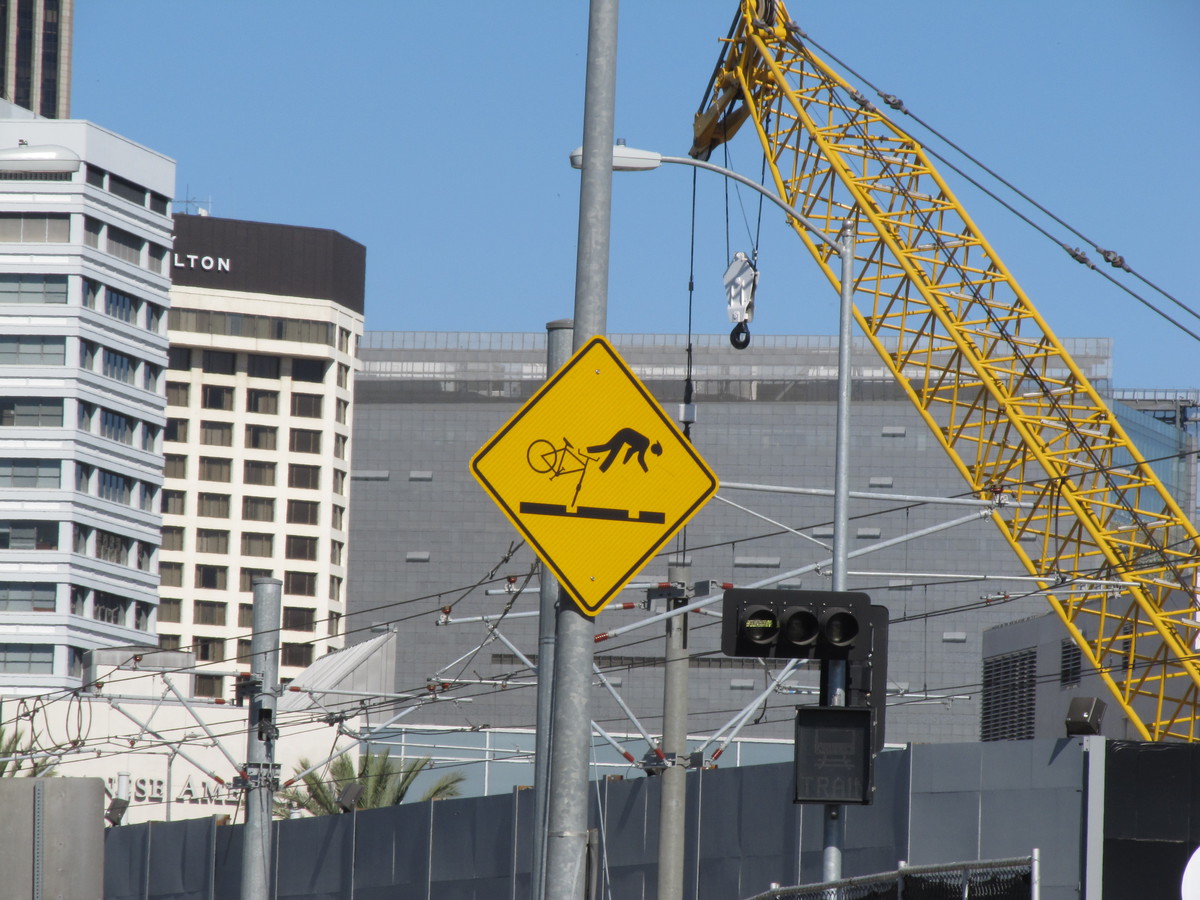
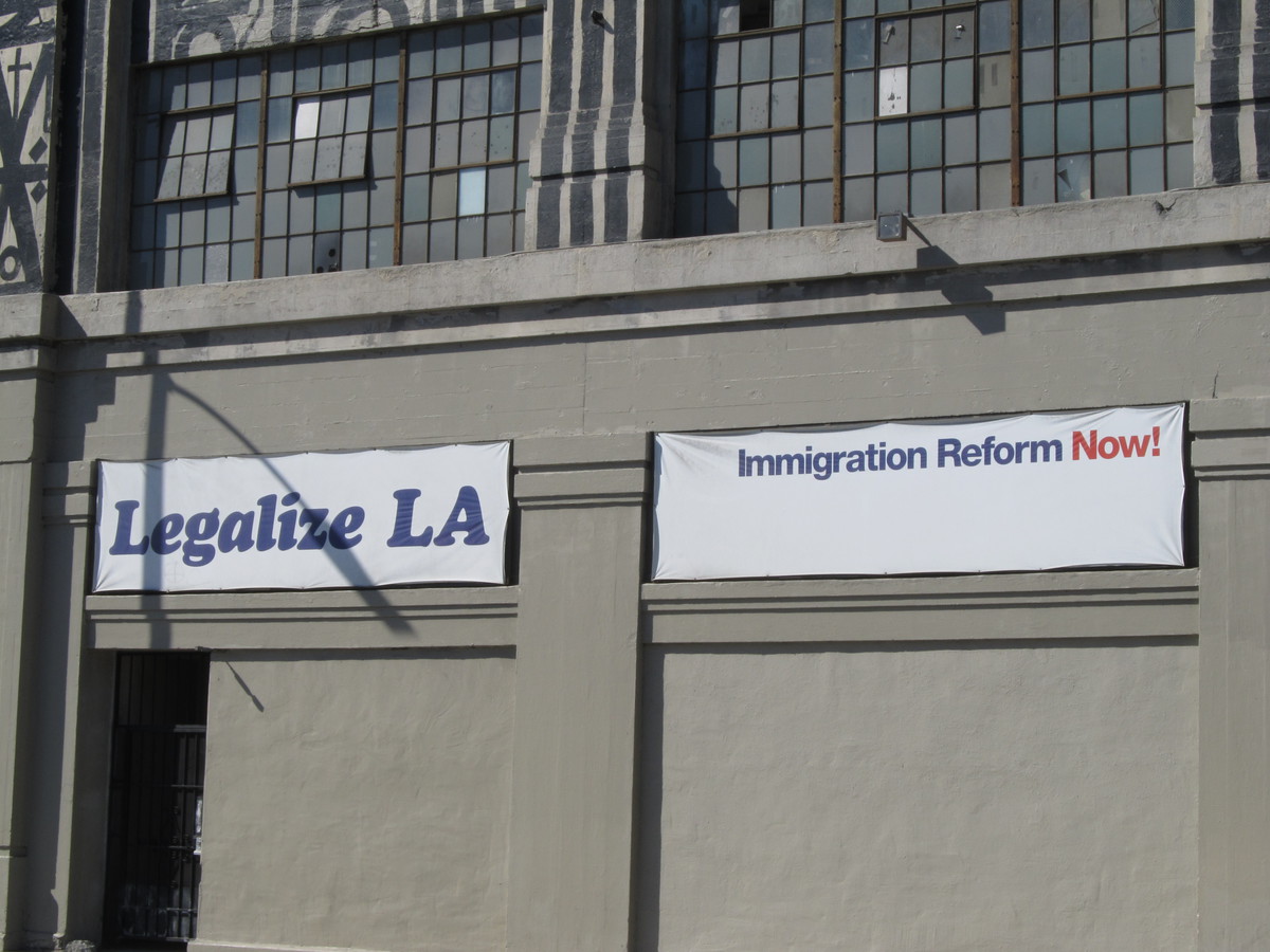
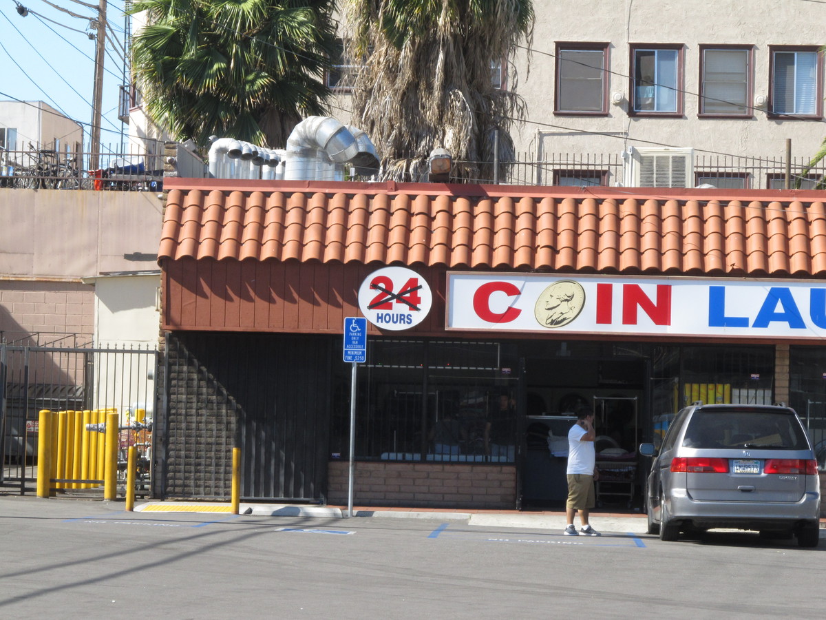
We started out riding into downtown L.A. We made one short stop to see how they are coming along with building the tunnel entrance for the Metro Regional Connector on 1st St. And that’s where we saw yet another classic ’stick-man-in-peril’ sign. Then we continued on down through the Arts District until we got to 7th St. We rode across downtown and out to Westlake on 7th, which is where we saw the formerly-24-hour laundromat. Then we turned up Bonnie Brae and got a good look at number 666. As we’d heard, the building next door was burned to the ground. But number 666 was actually pretty badly damaged as well.

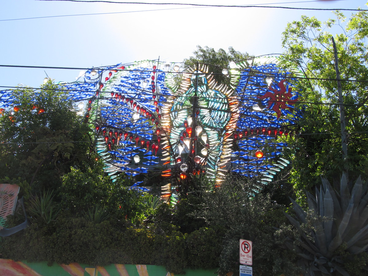
Continuing north, we rode up to Echo Park, where we made one more short side trip to see Randyland. Then we stopped off for snacks at Chango Coffee.

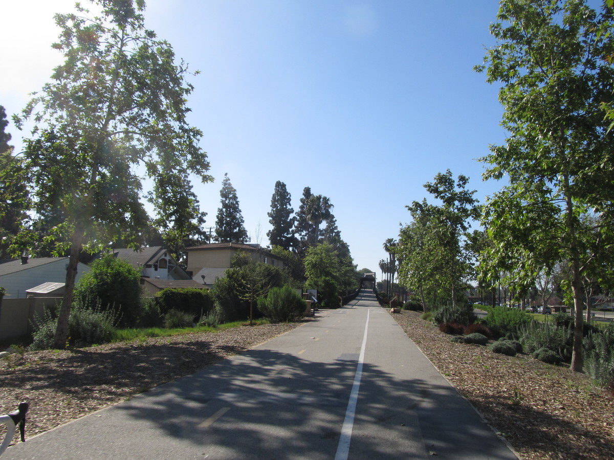
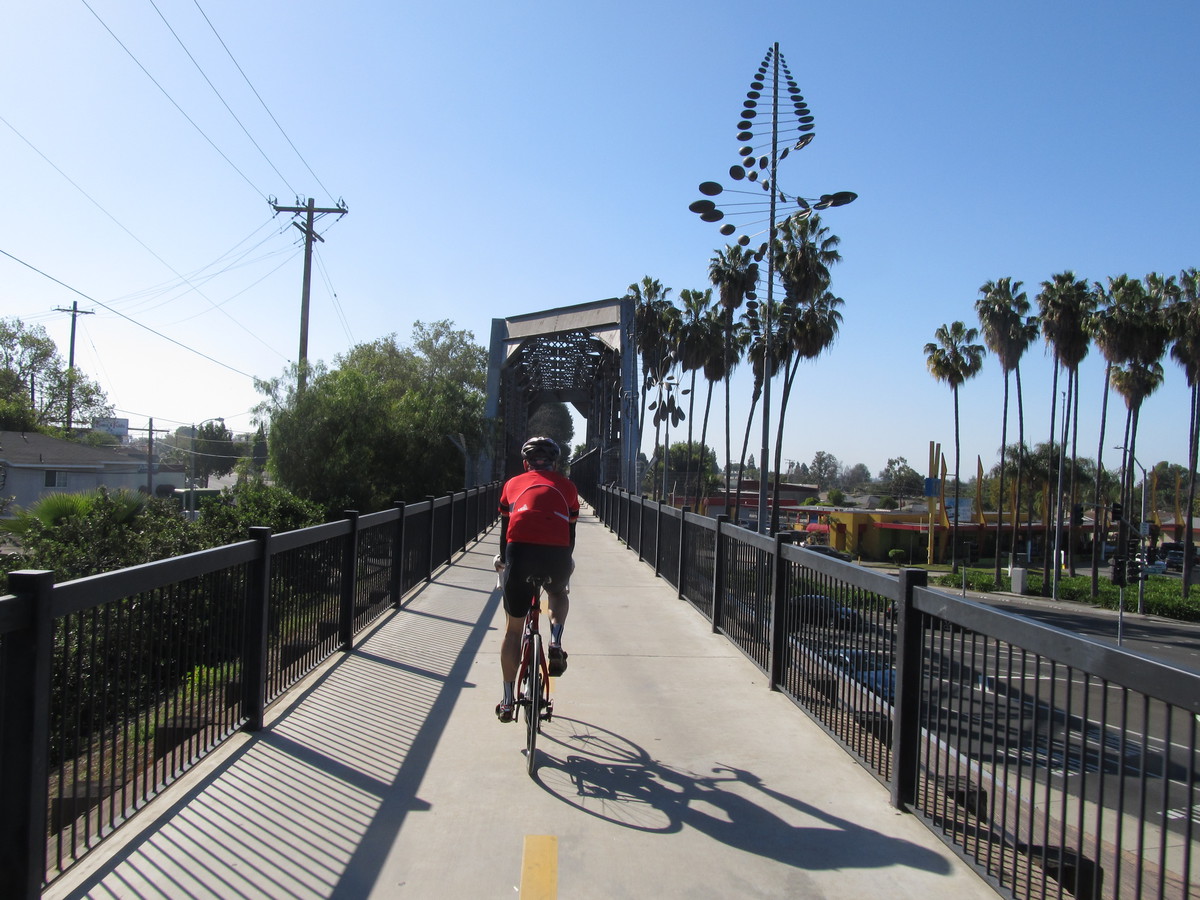
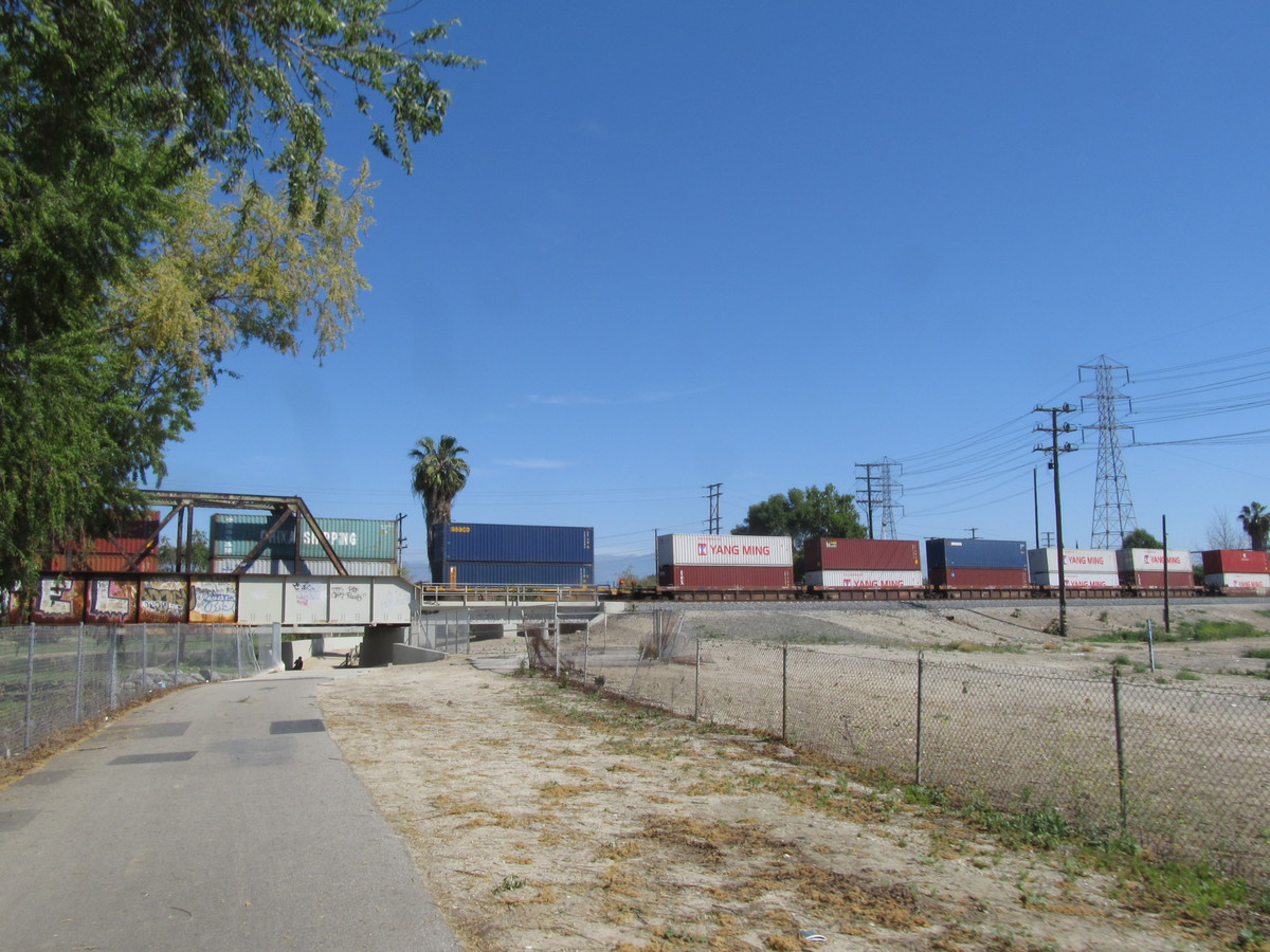
The route home took us through Echo Park to the L.A. River, and then back down the bike path to the bridge and Figeuroa St.

40 miles.

Route map and elevation profile

4/23/2017

Off to the Races

Filed under: — stan @ 3:27 pm

Today’s bike club ride was another special one-way ride. Out to Westchester, next to LAX, to see the L.A. Circuit Race. I knew that my old racing friend Cleave from the ’70s was going to be there. Remarkably, 40 years later, he’s still racing.

The route out there was almost the same as the route we took when we rode to Santa Monica last year. Through downtown, and then out to the west side by way of the Expo Line bike lane. At La Cienega and the old Air Line bridge, we picked up the Ballona Creek bike path and rode that down to the ocean by Marina Del Rey. Then we turned left and headed up the hill to Westchester.

When we got to the race I took a moment to ask around to see if the young girl racer we’d met on the Metro last fall was racing there. Sadly, the people from her club said she’d crashed, and her arm was in a cast. So I continued on until I found the group from Lightning Velo in Long Beach. And Cleave was there, having just finished racing. We talked a bit about racing in the old days in New York, and the races they used to have on Tuesday and Thursday evenings on Long Island. The one instruction we were all given at the start of each of those races was from the race master, Mr. Ando. He would tell us, “Don’t-a cross-a da double line-a!”

I hung around and watched the mens’ Category 3 and Category 4 races for a bit. I talked to a woman who turned out to be my age whose son was racing in the Category 4 race. She said he was going off to college in New York in the fall, so I told her what I knew about the racing scene there. NYC had a very good racing scene back in the ’70s, and it seems to be still going strong. The last time I saw it was in 2007, when I was there and made a point to go see the Wednesday evening races at the velodrome in Queens.

Leaving the race, it was time for the 10 or so miles back to the La Cienega Metro station. Which turned out to go by very quickly. There was a stiff tailwind coming off the ocean, and I was able to pretty much go top speed all the way there. Then I got on the train and rode it back to Pasadena.

45 miles, including riding home from the Allen Metro station

Route map and elevation profile

4/22/2017

Revisiting a bit of history

Filed under: — stan @ 3:09 pm

Today was a special short ride to go back and see the roads that were the course for the Acton Road Race, which was one that I rode in 1978. I wrote up the story of that day some years ago, but I’d never been back there until today. I’d only had a vague idea where the race was until last year when Kathleen and I went to Animal Tracks in Agua Dulce. That was when I realized that the start and finish line for the race was on Escondido Canyon Road, just north of the overpass over the 14 freeway.

I had a look at the map and mapped out the course. There aren’t that many roads up there that go through, so there really was only one way for it to go. And as it turns out, the loop was only 22 miles, rather than the 24 they told us it was on race day. And my recollection of it was that it had some climbs, but I don’t recall any major scary downhills. But today, seeing it in person for the first time since 1978, I find it amazing that I rode those descents in a full-speed racing pack and really didn’t think anything of it. It really was fun to be young and fearless.

The part of the course I really wanted to see what the big climb on Sierra Highway. That was where I lost contact with the pack on the last lap, but managed to catch up. This was the only race where I ever lost contact but was able to catch it again. And certainly the only race where I caught the pack after being dropped and went on to place in the top ten. So it was fun to see the site again. And since Jen was along for the ride, I got to tell the story again, even if telling a 39-year-old bike racing story made me feel a bit like Grandpa Simpson. But the important thing was that I had an onion on my belt…

Since there wasn’t really any place to leave the car near the starting line of the race, we parked at Vasquez Rocks and rode from there. And after riding the loop, along with a quick trip through Agua Dulce to get some cold water and see the sights, we went back in to Vasquez Rocks. I wanted to find the place where Captain Kirk faced off against the Gorn in the “Star Trek” first-season episode, “Arena”.

27 miles.

Route map and elevation profile

4/16/2017

Another ride to Hollywood

Filed under: — stan @ 1:59 pm

Today’s bike club ride was a slight variation on our usual route to go up to the Hollywood sign. The route out was the same as always, but coming back, instead of going up and over the hill into Burbank, we went back down and in to Hollywood.

On the way in, we took one small detour to stop and see the Chandelier Tree. After that, we continued on into Hollywood, turning up Beachwood Dr toward the sign. At the left turn at Belden, we started the real climb. This is probably one of the steepest streets that we ride up on a regular basis. At the top, we turned right and made our way to the spot where the street ends just below the Hollywood sign. From there, it looks like it’s just a short distance away, but it’s actually something like 500 vertical feet above us.

After looking at the sign, we rode down to Lake Hollywood, where we rode the loop around the reservoir and over the dam. This time, we were trying out a new route down into Hollywood. And it turned out that taking Deep Dell Pl and Holly Dr was a pretty good way to go. It had a nice little tunnel to pass under the freeway, where we were able to get on Franklin Ave.

We rode a few blocks down Cahuenga to the corner of Sunset and Groundwork Coffee. This is the little coffee shop were were at the time we heard about the Metrodome roof collapsing from the weight of the snow on it.

The route home involved taking Fountain Ave east out of Hollywood, then taking the L.A. River bike path south to its end. Then up Figueroa to get to the Arroyo Seco bike path. It was a nice ride, and the traffic seemed much less than usual, which may have been due to it being Easter. In any event, it was nicely quiet out there today.

43 miles.

Route map and elevation profile

4/9/2017

The TV Hall of Fame

Filed under: — stan @ 2:28 pm

I’m subscribed to the newsletter from Roadside America, which is a compendium of odd things to see all across the country. And this week, I found out about the TV Hall of Fame. They have a giant Emmy statue, surrounded by an outdoor garden with busts of famous TV people. And it’s all behind the TV Academy building at 5220 Lankershim in North Hollywood. We’ve been out that way lots of times, and I never knew it was there.

We rode out by the familiar route across South Pasadena, and then down Figueroa to the L.A. River. Then up the bike path, past the Zoo, and then out Riverside Dr across Toluca Lake. We made a somewhat roundabout route to end up in North Hollywood, where we found the TV Academy building. And just as advertised, there was a giant Emmy statue in the middle of the courtyard. We took a few minutes to wander around and look at the statues of famous TV people. The had a full statue of Johnny Carson right out front. Merv Griffin was nearby, and I always remember when we saw his headstone at the Westwood cemetery.

Other full-sized statues included Carol Burnett, Jack Benny, Lucy and Desi, and Carroll O’Connor and Jean Stapleton as Archie and Edith Bunker. We once went to see Carol Burnett’s star on the Hollywood Walk of Fame. I also thought it was appropriate that they had a bust of Philo Farnsworth. The TV Hall of Fame wouldn’t be complete without the inventor of television.

After that, we went around the corner to Panera in North Hollywood. We had some snacks before heading back home by way of the Chandler Bikeway across Burbank. Then up and over the Linda Vista hill to the Rose Bowl. By then, it had turned into a pretty nice day.

47 miles.

Route map and elevation profile

4/8/2017

Fight for Air – 2017

Filed under: — stan @ 8:36 pm

Today was the 2017 “Fight for Air Climb”. This is the stair climb up the Aon building in downtown Los Angeles. This was the first stair climb I ever did, back in 2009. And even though this marks the ninth time I’m doing this event, I’m not really trying to compete seriously any more. I’ve built a whole social circle in this sport, and I’ve gotten some recognition for making charts of the staircases, so I still like doing them just for the physical challenge, and to see all my friends there.

When it was time to go, I started my watch. My target pace was the same as I used in 2013, when I did a Vertical Mile in the Aon building one evening during a practice session. As it turns out, the climb from the ground up to the 4th floor is almost exactly the equivalent of four regular floors in the building, so I just aimed to check my watch at 4 1/2, 9, 13 1/2 and so on, and I managed to keep those markers right on the one-minute boundaries. The 1,393 steps to the roof works out to be the equivalent of 63.3 regular floors in that building. When I got near the top, I saw I was closing in on 14 minutes, which was pretty much right on target, since 9 times 7 is 63, and I was aiming to be doing 9 floors every two minutes. I tried to run right at the end to try and make the roof just under 14 minutes, but that didn’t quite work out. But my time of 14:02 was not bad for just taking it (relatively) easy.

My main criterion these days for measuring these things is to look at the results and see how many people my age or older went faster. If I can count them on the fingers of one hand, that’s a good day. And today, there was only one. So this was a good outing.

Results are here: https://my.racewire.com/results/33305/37785

4/2/2017

The Whittier Greenway Trail

Filed under: — stan @ 2:38 pm

We have ridden the parts of the Whittier Greenway Trail before, but today’s bike club ride was a trip to go and ride the whole length of it.

We took the direct route down to Whittier Narrows, and then the San Gabriel River bike path to get to Whittier, where we picked up the Greenway Trail. We stopped for a few minutes by Palm Park to look at the elaborate birdhouses there. The sign said they were intended to pay tribute to the architectural history of Whittier, and that the columns they were mounted on were salvaged from buildings that were damaged in the 1987 Whittier Narrows Earthquake.

Continuing on, we rode over the long railroad bridge that carries the trail over the big intersection of Whittier Blvd, Washington Blvd, and Pickering Ave. That was nice, although the other places where the trail crossed streets were not so elegant. A lot of the street crossings were kind of awkward, and really broke up the rhythm of riding on the trail.

At the end, we turned around and headed back the way we came. At Greenleaf Ave, we turned off and rode into downtown Whittier to Mimo’s Cafe for some snacks and drinks. Then we headed over to the San Gabriel River bike path for the ride home. It was a pleasant ride.

47 miles.

Route map and elevation profile

Powered by WordPress