Stan’s Obligatory Blog

10/28/2018

Down for the Count – 2018
Filed under: — stan @ 8:43 pm

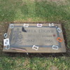
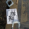
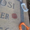
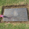
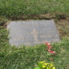
It’s the Sunday before Halloween, so it’s time for the annual “Down for the Count” ride to Culver City to visit Bela Lugosi’s grave. Someone comes and decorates for Halloween every year.

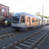
Our route out there is pretty straightforward. We head downtown, and then pick up the bike lane along the Metro Expo line out to La Cienega, and then the Ballona Creek bike path to Culver City. On the way back, we stopped at La Dijonaise in the old Helms Bakery building for snacks and drinks. I liked the signs they had outside the bathrooms. They truly were all-inclusive for men, women, and those in-between.

After snacks, we took Venice Blvd and 7th St back to downtown L.A. Then the Arroyo Seco bike trail to South Pasadena. At that point, I bailed out and took Metro Rail just to get home a little earlier, since I was planning on going back downtown to go see the Hapa.Me exhibit at the Japanese museum in Little Tokyo.

50 miles.
Route map and elevation profile

10/21/2018

Michael Myers

Filed under: — stan @ 2:15 pm

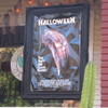
Today was the first of two planned Halloween-themed rides. I recently read that the 1978 film “Halloween” was largely filmed in South Pasadena, and in particular, the house that Michael Myers lived in is a designated historical landmark, and had been moved to a location right next to the Metro Station in South Pasadena. So that was our sightseeing for today.

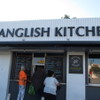
South Pasadena isn’t very far away, to the actual sightseeing was early in the ride, but that’s all right. We rode down there and saw the house. Then we continued on and made a big loop down to Montebello, and then up the San Gabriel River to Duarte. Along the way, we passed the Spanglish Kitchen in Alhambra. From the reviews, it sounds pretty good. After riding up the river bike trail, we rode into Monrovia to have snacks at Merengue.

Coming home, we rode through Sierra Madre for the first time in a while.

44 miles.

Route map and elevation profile


10/14/2018

The Berlin Wall

Filed under: — stan @ 2:24 pm

Today’s bike club ride was visit to the Berlin Wall on Wilshire Blvd, across from Hancock Park and the Tar Pits. It’s reputed to be the largest piece of the Wall outside of Berlin. We’ve been to see it before, but the last time we were there, we got rained out on the way home. Today was much nicer. No rain, and snacks at the Curson Cafe in Park La Brea.

45 miles.

Route map and elevation profile

10/7/2018

In-N-Out Burger

Filed under: — stan @ 8:30 pm

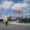
Today’s bike club ride was a trip to Baldwin Park to see the In-N-Out Burger museum and replica of the original In-N-Out. We’ve been there before, and we planned the route so that we would arrive there when the museum opens at 11:00. We took the little tour, and some photos, and then rode home.

43 miles.

Route map and elevation profile

Powered by WordPress