Stan’s Obligatory Blog

10/29/2017

Down for the Count – 2017

Filed under: — stan @ 3:09 pm

It’s the Sunday before Halloween, and time for our annual Halloween-theme ride to Culver City to visit Bela Lugosi’s grave. We’ve been doing this since 2007. It’s a slightly longer ride than we usually do, but it’s a relatively flat route.

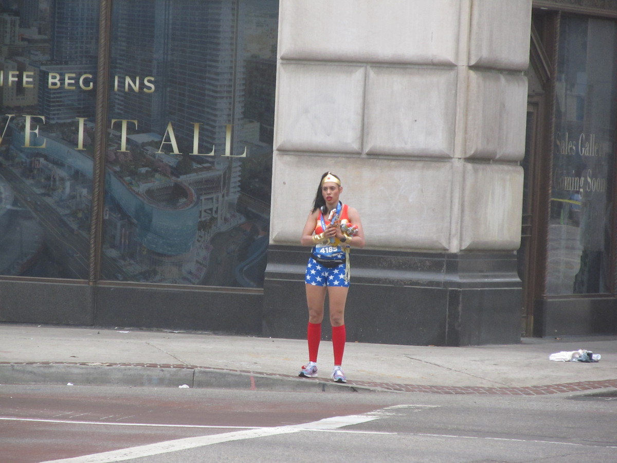
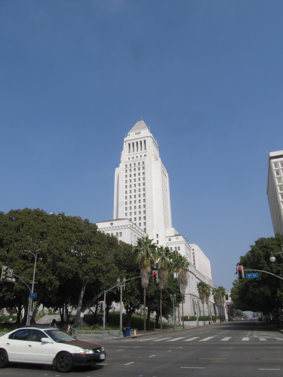
We too our regular route, which involved going downtown, where the Rock-n-Roll Half Marathon was going on. We saw Wonder Woman there, along with hundreds of other runners in costumes. Then we headed south to USC, and then out on the Metro Expo Line bike lanes to Culver City. There, we got on the Ballona Creek bike path and rode that to Overland Ave, where we turned off to go to the back entrance to Holy Cross cemetery.

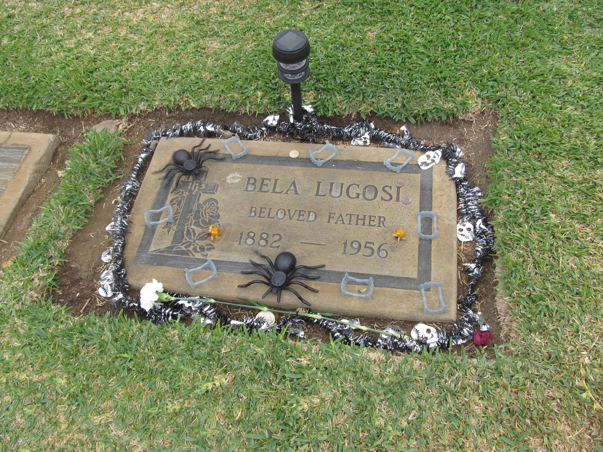
People generally show up to decorate Bela Lugosi’s grave for Halloween, but this year we apparently special. The tinsel garland, spiders, and a little lawn light were more than we’ve ever seen there before.

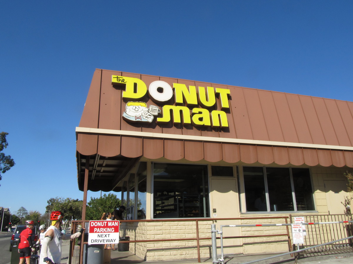
We stopped for snacks at La Dijonaise in the old Helms Bakery complex. Then we headed back by way of Venice Blvd, and then 7th St back into downtown. In the end, I cut the route short slightly by taking Metro back from South Pasadena. This was largely to save some time at the end, since the full round-trip is about 56 miles.

50 miles.

Route map and elevation profile

10/22/2017

P-22 Day

Filed under: — stan @ 5:01 pm

This morning, when we were riding through Griffith Park, I saw a sign for the P-22 Day Festival. This was in honor of P-22, the famous Griffith Park puma. So after I got home, Kathleen and I went back to the park to go see it.

There were booths with exhibits about wildlife conservation, and mountain lions in particular. About plans to build a wildlife overpass over the 101 freeway, since crossing freeways is one of the most dangerous things that wild animals have to do. The had a stuffed puma that had been killed by poachers so we could see what it looked like up close.

It was an odd little event, but fun in its own way.

The Chili Bowl

Filed under: — stan @ 2:07 pm

Back in the ’80s, I found a book called California Crazy about the odd architecture found around L.A. The few remaining weird buildings have formed the basis for many of my bike club routes. And today was yet another. Back in the 1930s, there was a chain of restaurants called Chili Bowl. These were in bowl-shaped buildings, and there are only a few remaining. None of them are still Chili Bowl restaurants, but the buildings remain. And today’s ride was to go see one of them still standing in Glendale.

Glendale isn’t very far away, so I made up a route based on the route we used to go see the Derby Dolls bubble soccer back in July. We made a big loop from almost downtown L.A., up through Griffith Park, NoHo, and Burbank. We stopped in the shade at the Groundworks Coffee in the old Pacific Electric depot in NoHo before heading back into Glendale and seeing the former Chili Bowl. In the end, the route turned out to be a bit longer than I’d thought, but it was a nice day, so that was all right.

46 miles.

Route map and elevation profile

10/15/2017

Donut Man

Filed under: — stan @ 2:35 pm

Today’s bike club ride was a trip to Glendora to visit Donut Man. The group went there another time, but that was a weekend when I was out of town, so I wanted to go back so I could try it.

We fought a headwind all the way out there. But that made us feel like the donuts were more easily justified. And they were pretty good.

On the way back, we saw some nuns crossing the road, right near the Nun Crossing sign. That’s the first time I’ve ever seen actual nuns outside there.

37 miles.

Route map and elevation profile

10/14/2017

San Andreas Fault with Atlas Obscura

Filed under: — stan @ 7:51 pm

Today was yet another edition of the Atlas Obscura San Andreas Fault Scavenger Hunt. This is the third time I’ve been doing this tour with Atlas Obscura, and it seems to be as popular as ever. This time, my partner for leading the tour was my friend Morgan from the office.

We all met at the Seismo Lab, and we started off with a quick tour of the lab. We saw the lobby exhibits about the history of earthquake study, the media center upstairs, and a small exhibit about Charles Richter and Beno Gutenberg, who started the Seismo Lab and systematic study of earthquakes back in the 1930s.

The first stop of the tour was the small fault scarp next to the McDonald’s drive-through in San Fernando. This is a small remnant from the 1971 Sylmar earthquake.

The next stop was the scenic overlook and the famous road cut along the fault in Palmdale. When we were walking up the hill to look at the road cut, we ran across a tour group of students from Long Beach State. They were apparently doing about the same tour as we were, but traveling in the opposite direction.

We stopped for lunch at Charlie Brown Farms, which is still a deeply weird place. This time, I noticed that they had camel meat in the freezer. I suppose it tastes like chicken…

After lunch, we had a pair of stops close together. One at the signs marking the fault, and then at the Pallet Creek trench site, which was where the science of paleoseismology was born. The signs are kind of a silly stop, but it’s a chance for a photo-op. The trench site is interesting from the standpoint of it being important to the history of science.

Now it was time to go into the mountains. We stopped at the road cut that has the fault gouge on one side, and we showed everyone how the rocks in the sand could be crushed by hand. That’s always popular. Then we continued on to Wrightwood.

The last stop was at Lost Lake in Cajon Pass. Last year, it was suffering from three years of drought, and the lake had no water in it. But this time, it had some water, and was actually a lake.

And that was our tour.


10/1/2017

The Whittier Narrows Earthquake

Filed under: — stan @ 2:33 pm

Today is the 30th anniversary of the Whittier Narrows Earthquake. This was felt all over Los Angeles, and it caused some significant damage in nearby towns. So today’s bike club ride was to visit a few locations associated with the earthquake.

The first stop was at the San Gabriel Civic Auditorium. This building was damaged and later repaired. You can see a photo of the damage here:

http://scedc.caltech.edu/significant/whittier1987.html

We could see that the upper portion had been patched up, and there were still some cracks in the lower part of the building.

The next stop was the epicenter, which was just a few blocks southeast of the big intersection of Walnut Grove and Garvey in Rosemead. Not really much to see there, but that’s the place.

Next we rode to the Whittier Greenway Trail, where we saw a display of bricks and columns that were salvaged from a few historic buildings that were damaged enough that they had to be torn down. Then from there, we rode into downtown Whittier, and our snack stop at Mimo’s Cafe.

The last stop of the tour was at the Whittier Museum, which is hosting an exhibit about the earthquake. The building pictured on the banner outside was just a few blocks away.

Here are some more pictures from that day:

http://www.nbclosangeles.com/news/local/Whittier-Narrows-Earthquake-Puente-Hills-Fault-California-Seismology-Photos-Images-448452433.html

45 miles.

Route map and elevation profile

Powered by WordPress