Stan’s Obligatory Blog

5/28/2017

Nick Metropolis

Filed under: — stan @ 4:16 pm

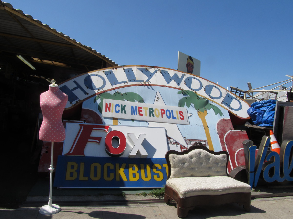
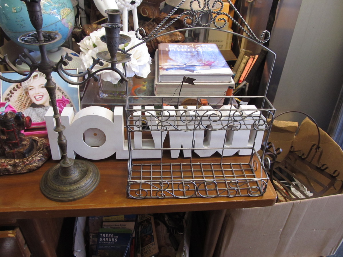
This past week, the Los Angeles Times had an article about Nick Metropolis. This is an odd little place on La Brea, filled with all sorts of weird junk. So of course, we had to go see it.

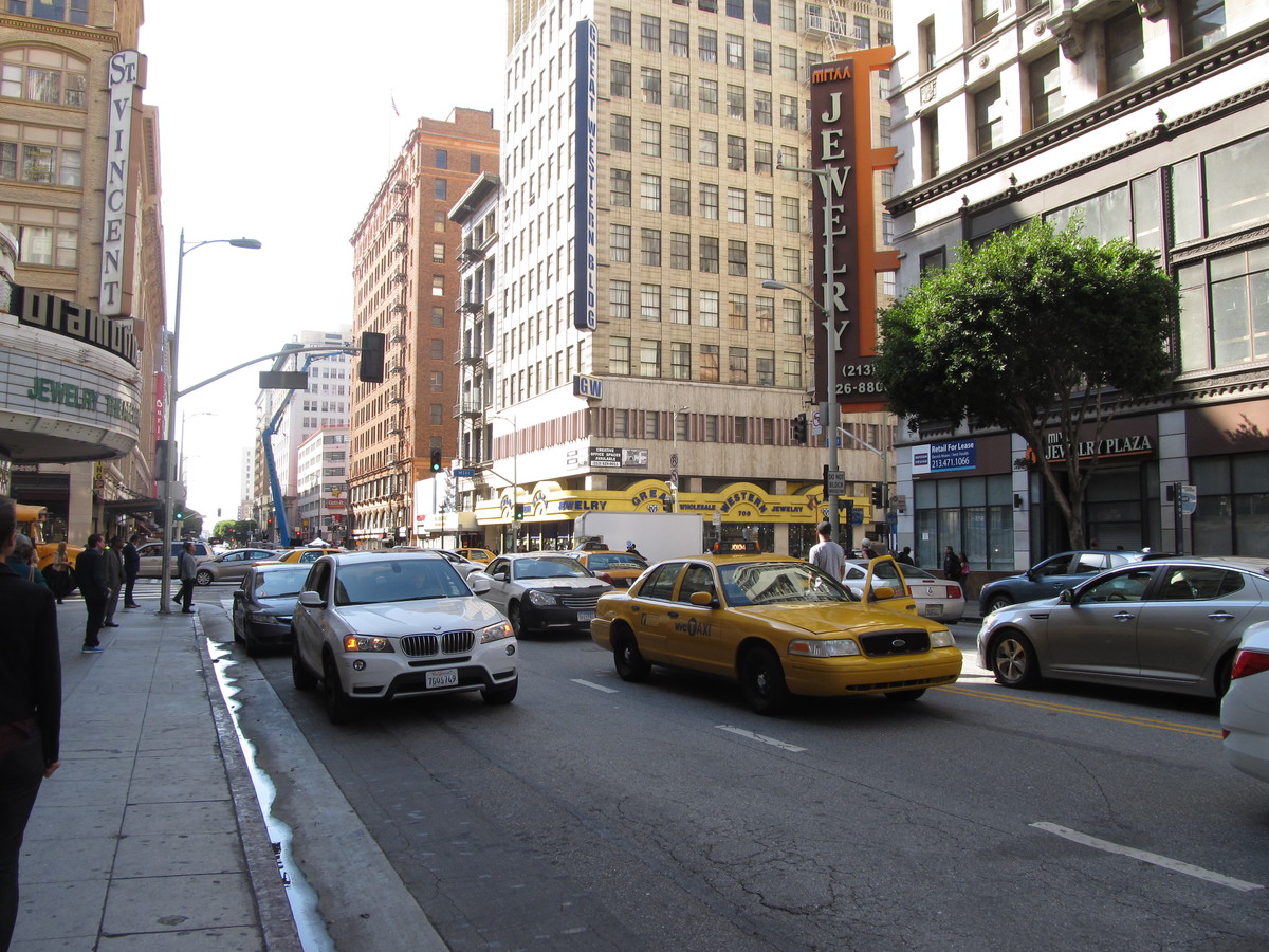
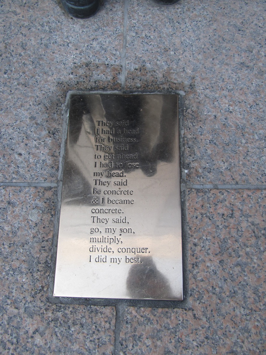
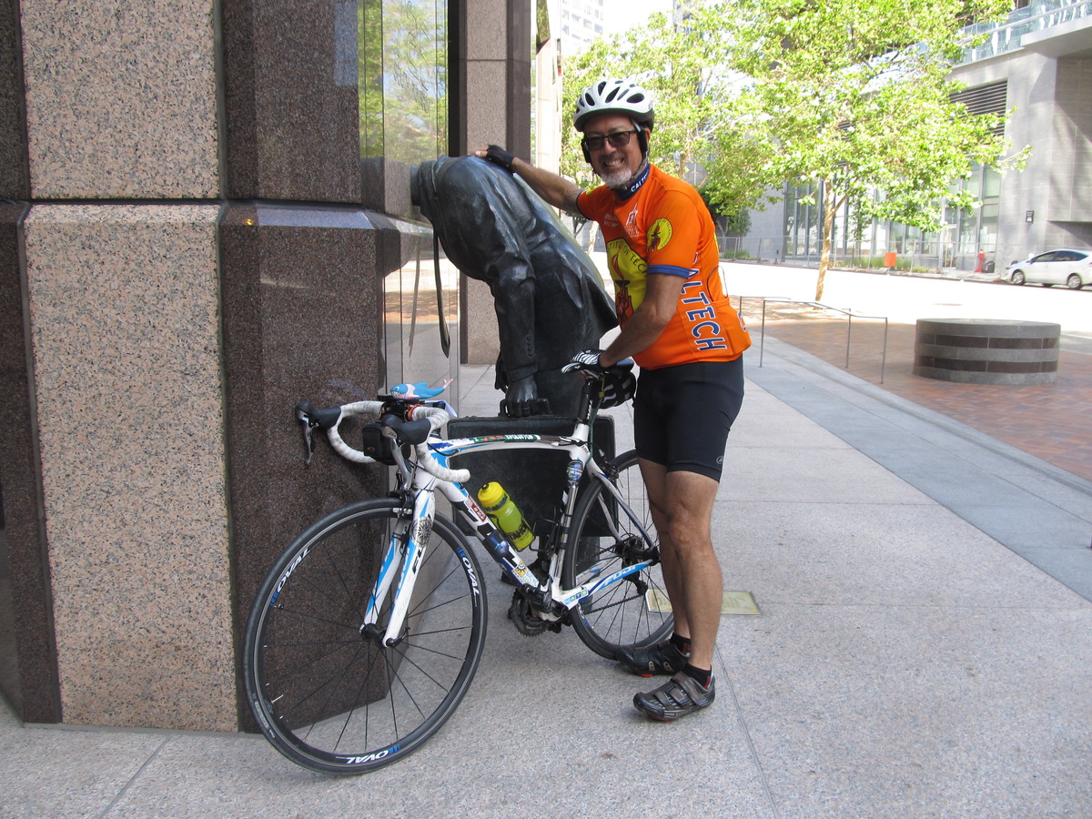
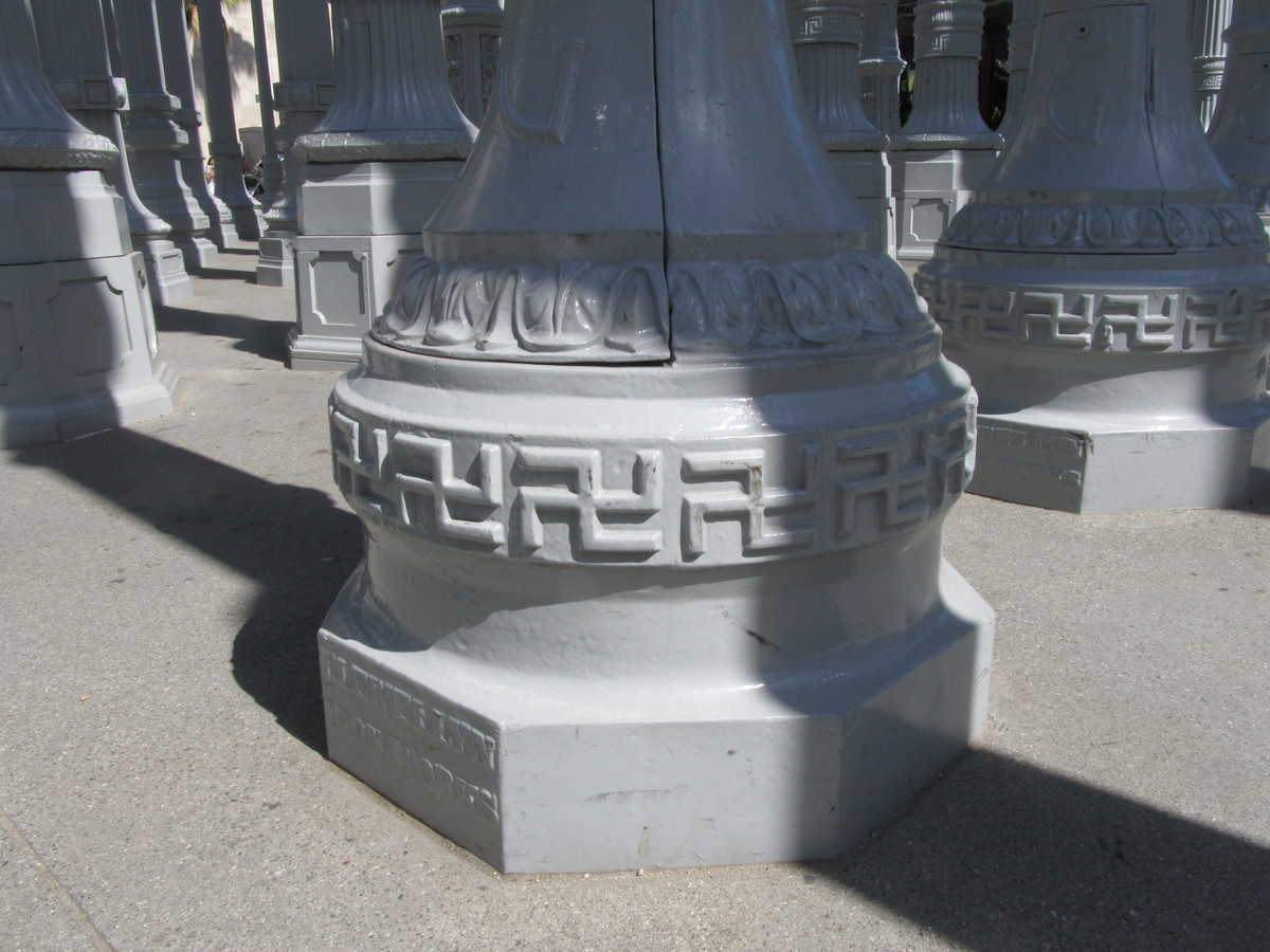
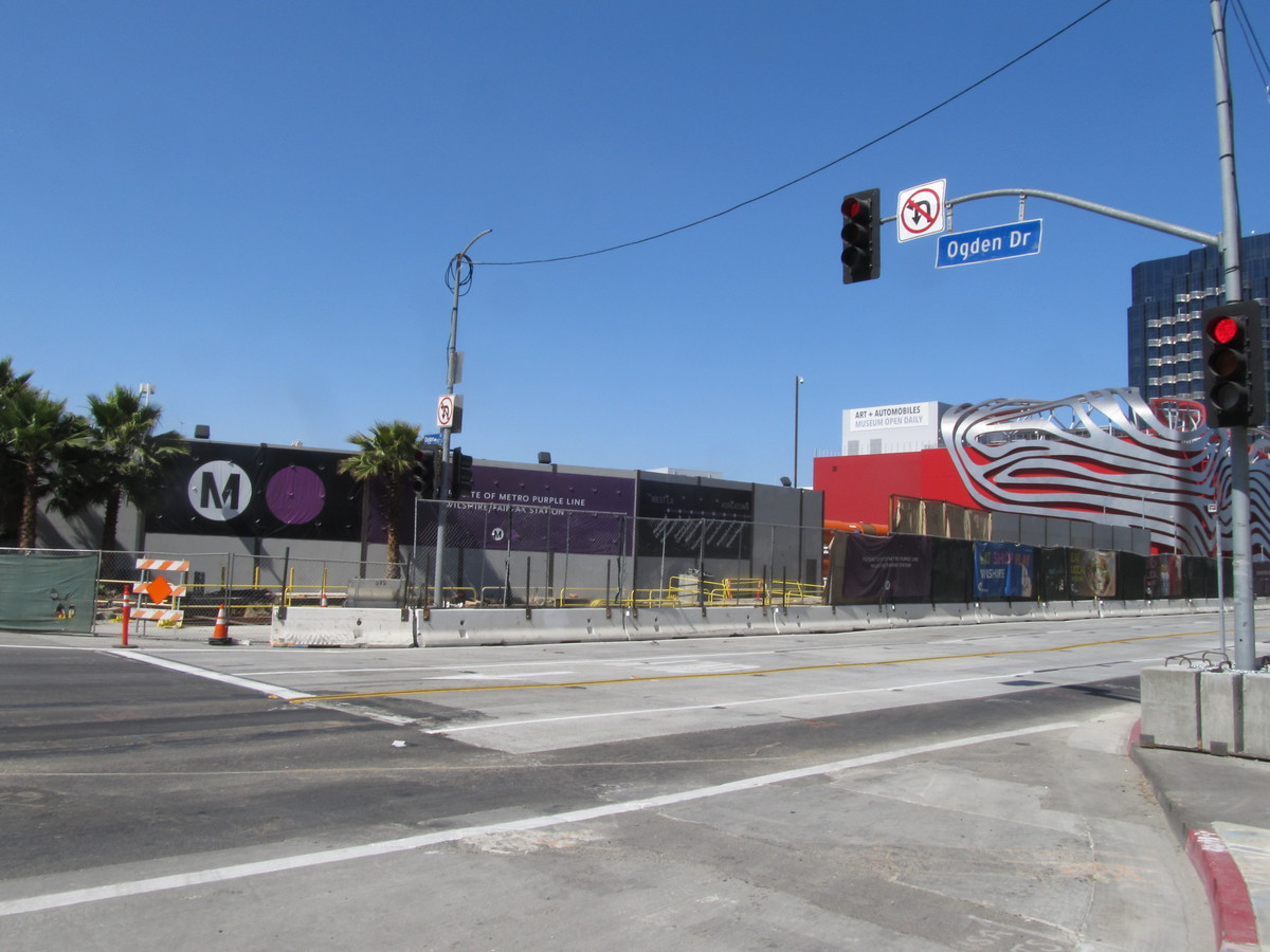
The ride out was our regular route through downtown L.A. We stopped briefly at 7th and Figueroa to see the Corporate Head sculpture. Then we continued on out through Koreatown and Hancock Park. We went all the way to Fairfax so we could see the construction site for the new Metro Purple Line station there. We also had a look at the “Urban Light” installation at LACMA. I noticed for the first time that some of the streetlights in it are the antique ones with swastikas around the base.

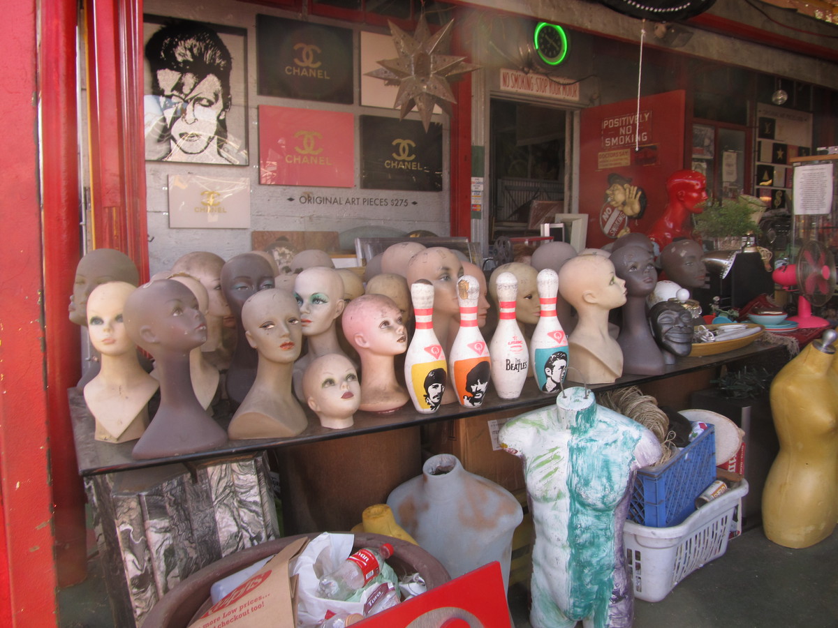
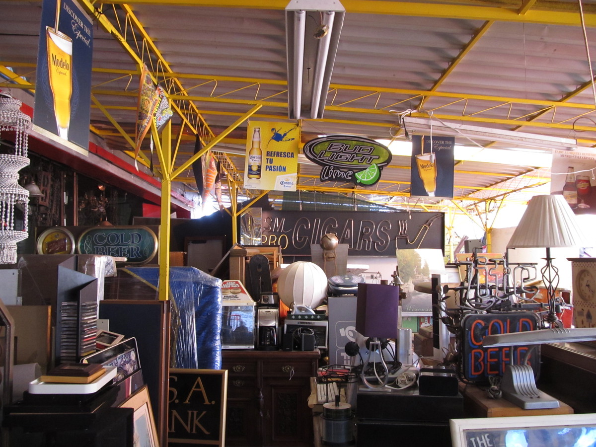
Heading back east, we got to Nick Metropolis, where we had a chance to look around. It is one weird collection of stuff there.

Our snack stop was at Noah’s Bagels on Larchmont. While we were there, we took a look at the little bakery that just opened up next door. I think we’re going to try going there next time we’re out this way.

The route home was the usual way across Silver Lake and home by way of York Blvd.

46 miles.

Route map and elevation profile

5/27/2017

Return to the George Harrison Tree

Filed under: — stan @ 1:44 pm

I don’t usually ride with the Foothill Cycle Saturday morning group, but today they were doing a ride that started from the park by my house, and they were doing one of my routes. The ride to Griffith Park to see the George Harrison Tree.

The route out was our standard route across Pasadena and through Eagle Rock to get to Hollywood. Then we turned and made our way up the hill to Griffith Observatory. They’ve changed the traffic pattern there since the last time we were there, and the two road leading up to the observatory are now designated as one-way, with one leading up, and the other leading down. So we had to ride through the tunnel to Toontown to get to the road up to the observatory. When we got up to the top, I went for the photo-op with the bust of James Dean, and also had a look at the orbits of the planets in the sidewalks in front of the observatory. I’d thought they didn’t have the orbit of Pluto plotted on there, but it turned out they did.

Leaving the observatory, we headed up Mt Hollywood Drive. We took a short side trip to an overlook that had a nice all-directions view of the park and the city. And after we rolled over the crest of the hill, we started down the Valley side, with a short stop at “Cathy’s Corner”, which was the location for the “What a Waste of a Lovely Night” scene from “La La Land”. I’m in the process of making up a theme ride to visit some of the “La La Land” shooting locations, and this is one of the more important ones on the list.

Continuing on down the mountain, we got to the bottom, where we turned left to head over the our snack stop at Priscilla’s in Burbank. We had drinks and snacks there, before starting for home. We rode back to the L.A. River bike path, which we took all the way to its south end at the bridge to Figueroa St. We took Figueroa north to Ave 57, and then turned off to get to Monterey Rd back to South Pasadena.

All told, it was a nice ride.

47 miles.

Route map and elevation profile

5/21/2017

The old NoHo train station

Filed under: — stan @ 2:56 pm

A few weeks ago, we did a ride to see the TV Hall of Fame in North Hollywood. That day, we stopped for snacks at Panera at Chandler and Lankershim, and while we were there, I saw a sign on the old North Hollywood Pacific Electric Depot that said that they had finished renovating the old building, and that a new Groundwork Coffee was now open inside. So today’s ride was a trip out there to see the old station.

It’s become something of a tradition to renovate old train stations for retail and restaurant use. The former Pasadena stations has several restaurants in it. The old Monrovia station is being renovated with an eye towards that sort of use. So the NoHo station is just the latest in a long line of these sorts of projects.

We took a bit of a roundabout route to get to NoHo, going down almost to downtown, and then up the L.A. River bike path. And also a bit out into Studio City. But it was a nice day for riding, so it was all right. When we got to NoHo, we turned in to the old train station. The Groundwork Coffee shop there is pretty nice, and they have a large shaded outdoor seating area, which was just the thing today. We had some drinks and snacks before heading back.

The route back was a bit more direct. Straight across Glendale and then over the hill to get to the Rose Bowl. The Bowl was on virtual lockdown, since they’d had a big U2 concert last night, and were preparing for another tonight.

In the end, it was a nice ride, although it did get pretty hot today. When I got home, my little weather station thingy said it was 99 degrees, which is a bit much for this early in the season.

47 miles.

Route map and elevation profile

5/14/2017

Where the Streets Have No Name

Filed under: — stan @ 2:01 pm

Today’s bike club ride was a visit to see a little piece of rock history. In 1987, U2 made a video for their song, “Where the Streets Have No Name” where they played a small show on the roof of a building in downtown Los Angeles:

beta.theglobeandmail.com/arts/music/u2s-where-the-streets-have-no-name-30-yearslater/article34932271/

Today’s bike ride was a trip to downtown L.A. to see the building and the corner where they did this.

We rode down through South Pasadena and Highland Park to get to the L.A. River and the new bridge there. We stopped for a minute to look at the “Faces of Elysian Valley” art installation in the traffic circle just before the bridge. Then we headed up the river trail to Fletcher, where we got off and headed into Hollywood. We had take a short detour between Bronson and Gower where there was something happening and Hollywood Boulevard was blocked off with fire trucks and police cars.

We rode across Hollywood, and I was slightly surprised to find that not only did U2 not have a star on the Hollywood Walk of Fame, but they don’t have a presence at the Rock Walk at Guitar Center on Sunset.

Our snack stop was at Noah’s Bagels in Larchmont. Then we headed back into downtown L.A. via 7th St. When we got to Main, we stopped and looked at the building. It was a liquor store back in 1987, and it’s a Mexican restaurant now, but the building looks essentially the same now as it did then.

From there, we headed back up Main St, stopping to take a photo of the Car Freshener painted on the side of a building at 3rd St. As they say, “[you'll] find one in every car…“. We also saw the signpost pointing to all of the sister cities that Los Angeles has around the world. Just in case you were wondering.

45 miles.

Route map and elevation profile

5/7/2017

The Metro Tour East

Filed under: — stan @ 1:12 pm

The weather forecast for today was for it to be chilly, with a small chance of rain. So the ride for today was the Metro Rail Tour East. This is a ride to Glendora and back, never more than two miles or so from the nearest Metro Rail station.

I went down to the park, but in the end nobody else showed up. So I set out on my own. It sprinkled just a little bit for the first few minutes, but then that stopped, and the sun came out. So I did the whole ride, and it was fine. Fine, except for the stiff headwind all the way to Glendora. But coming back was nice. Gladstone St is about 1% downhill, and with the tailwind, I was pretty much able to glide a good bit of the way back.

37 miles.

Route map and elevation profile

Powered by WordPress