Obama Boulevard
 |
 |
This past week, I saw an item in the L.A. Times that the city was going to have a street fair and party to celebrate renaming Rodeo Road in Leimert Park to be Obama Boulevard. So I thought that this would make for a good destination for the Sunday bike ride.
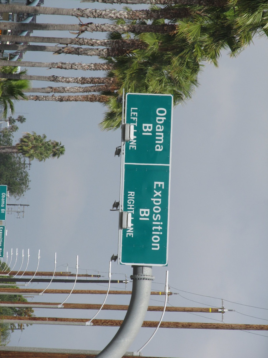
We rode our usual route to downtown L.A. Along the way, I got a flat, which caused a little delay. But aside from that it was fine. While I was fixing my flat, part of the group kept going. I figured we’d find them later on the route. We rode down past USC and out Exposition Blvd. Just after Western Ave, we saw the signs for the fork in the road where Obama Blvd begins. We rode on it for about a mile to just past Crenshaw, and then turned north to get to Noah’s Bagels. When we got to the bagel shop, the rest of the group wasn’t there. I was just wondering what could have happened to them when they rolled up. They had taken a wrong turn due to the fact that the city has only changed a few of the street signs so far, and most of the signs still say Rodeo Rd. Still, it was a fun ride.
44 miles.