I’d like to call this ‘a cautionary tale’…
 |
 |
 |
 |
 |
 |
 |
 |
 |
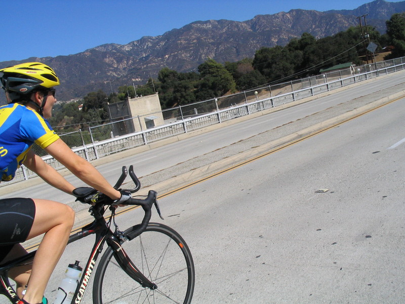
Today’s ride began badly and never really recovered. I’d like to call it ‘a cautionary tale’, but sadly, there really was no message of caution to be taken from the experience. About the best thing that you could say was that nobody died. Still, it’s disturbing how fleeting life is. You can be just going along, minding your own business, and you can suddenly be taken out by someone else who does something egregiously stupid.
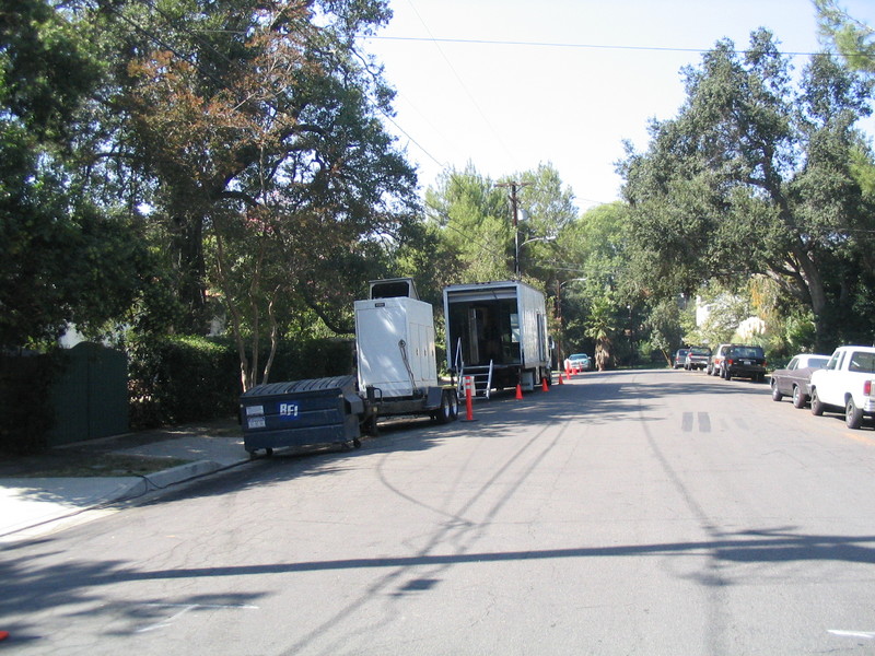
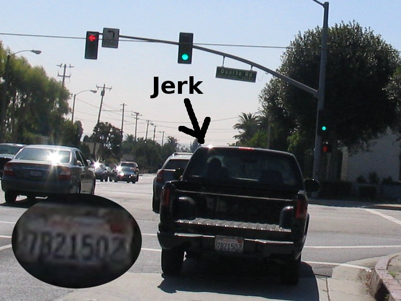
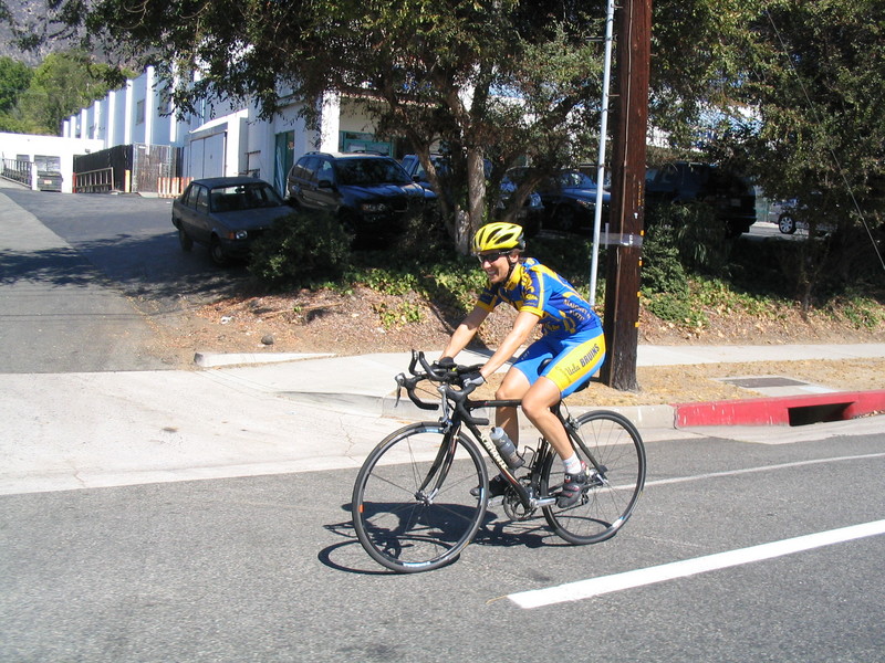
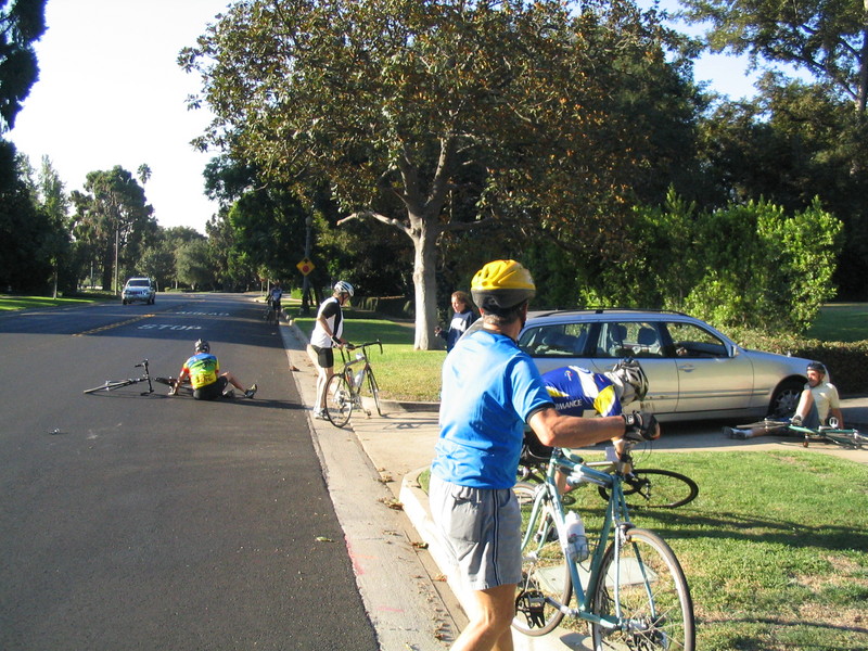
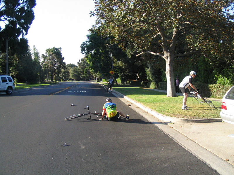
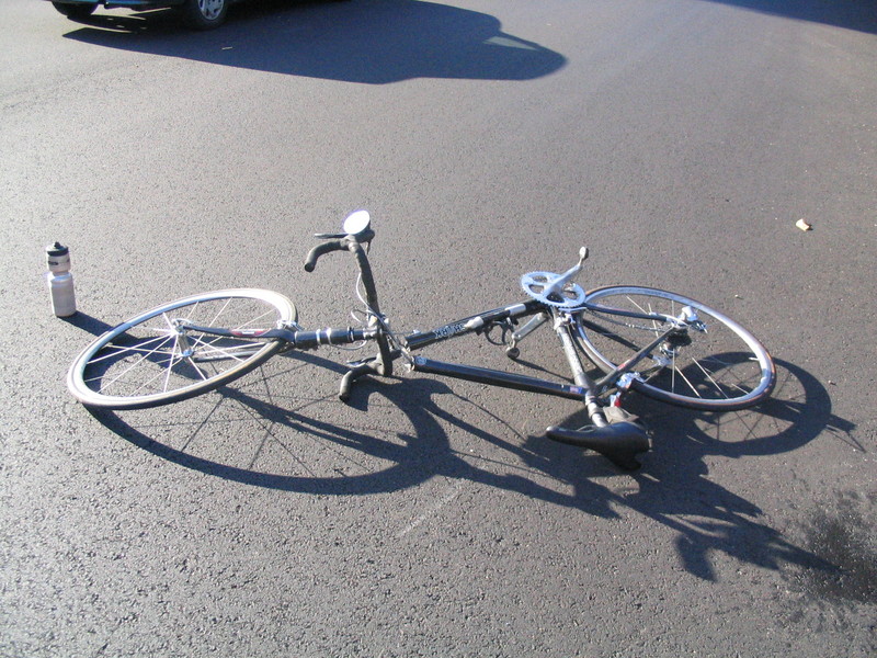
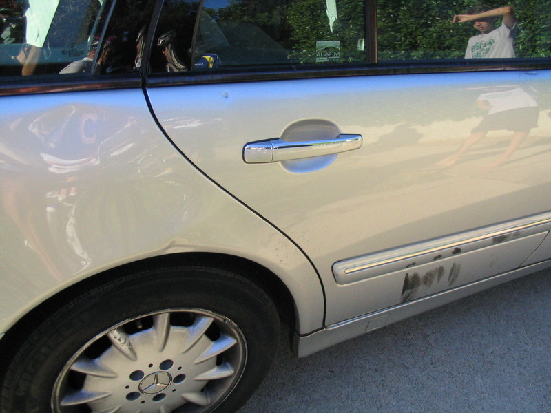
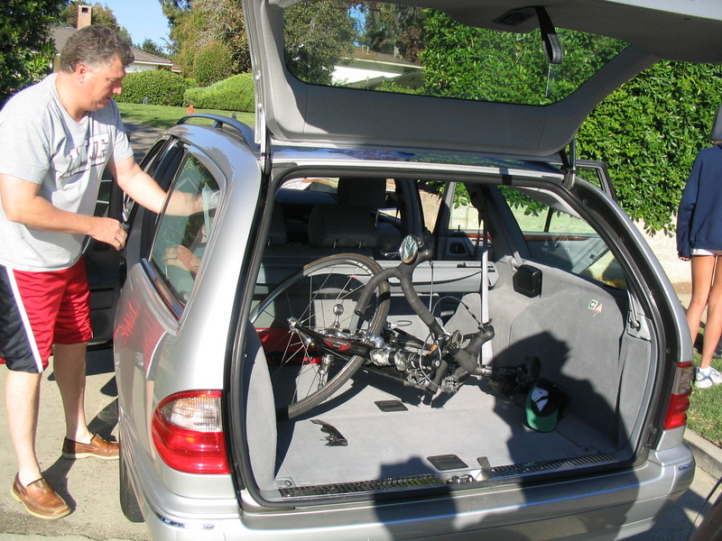
I rode down the Victory Park to meet up with the Foothill Cycle Saturday ride. From there, we rode south into San Marino. And that was where our troubles began. We were riding down San Marino Blvd when we were passed by a silver Mercedes driven by a teenage girl. She immediately put on her brakes and turned into a driveway. Tom and Ben were in the lead, and they both crashed into her car. The rest of us managed to stop in time. I got out my camera and started taking pictures just to document the scene in case there was any dispute about what happened.
It appeared that what she did was an honest mistake, albeit an extremely stupid one. A lot of motorists seem to regard bicycles as stationary objects, and they don’t understand that you can’t just stop and turn right after passing them.
After taking a few pictures of the scene, I took out my phone and called 911. That connected me to the California Highway Patrol, which wasn’t much use, since we were nowhere near a freeway. So I hung up and tried to call the Pasadena Police. As is the case with these sorts of things, I suddenly drew a blank on the number. So perhaps one lesson of this is to program the phone number of the police into the cell phone.
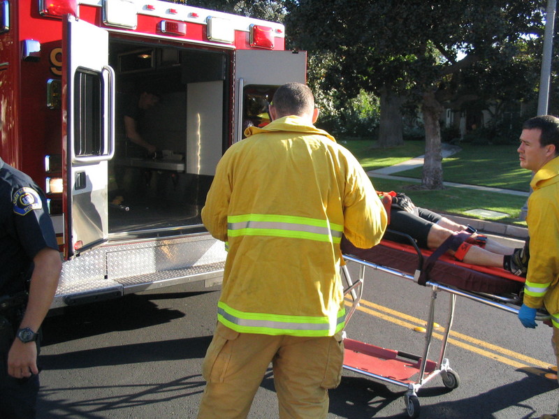
When I remembered the number, I called and told the dispatcher what had happened. She was very helpful, and connected me through to the San Marino Police. Have I mentioned lately that Pasadena has great city services? They said that they would send a car and the paramedics out. Within two minutes, they were there. San Marino also has great city services.
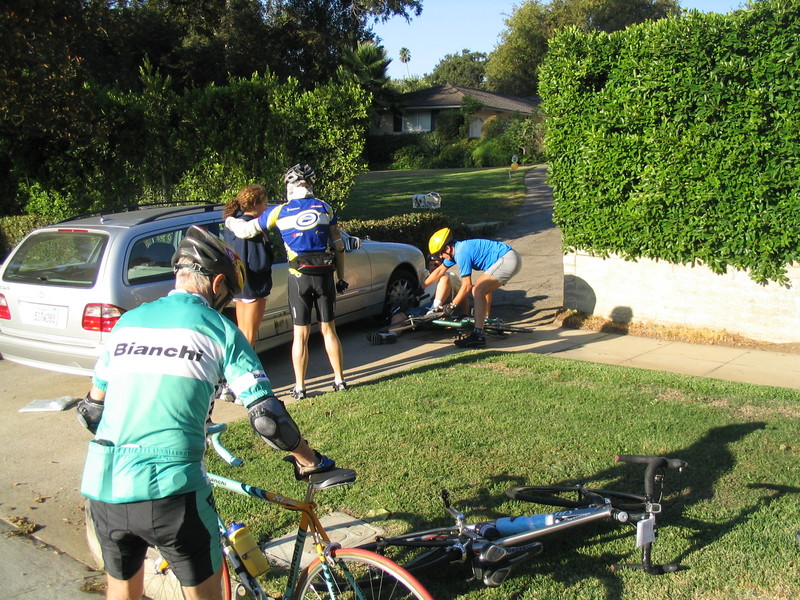
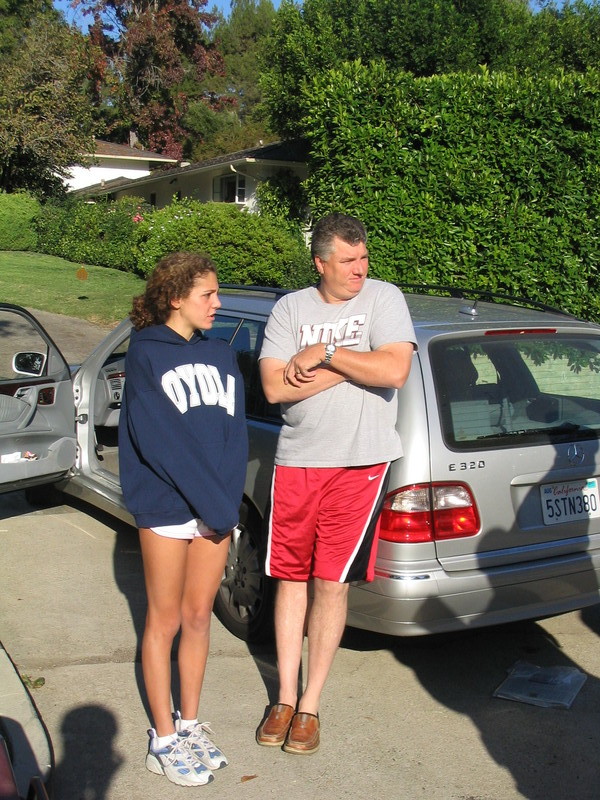
The police took reports from all of us, and I gave them my card in case they want the pictures. By then, the girl’s father had shown up. They offered to take Ben’s broken bike down to Temple City Bikes. It appeared that they were really making a good-faith effort to help out, which was a good thing.
The paramedics put Ben in the ambulance to take him to the hospital to be checked out. He said that he didn’t think he was badly hurt, but it seemed the prudent thing to do. Tom’s house was nearby, and he felt good enough to ride home, so he said he would call Ben’s family and tell them what had happened.
After all of this. a few of us decided to keep on riding. If you dwell too much on all the bad things that can happen to you, you’d never leave the house. So we soldiered on.
In South Pasadena, we rode up a very steep and generally nice hill. Then we rode slowly down the other side. We were all still a bit spooked.
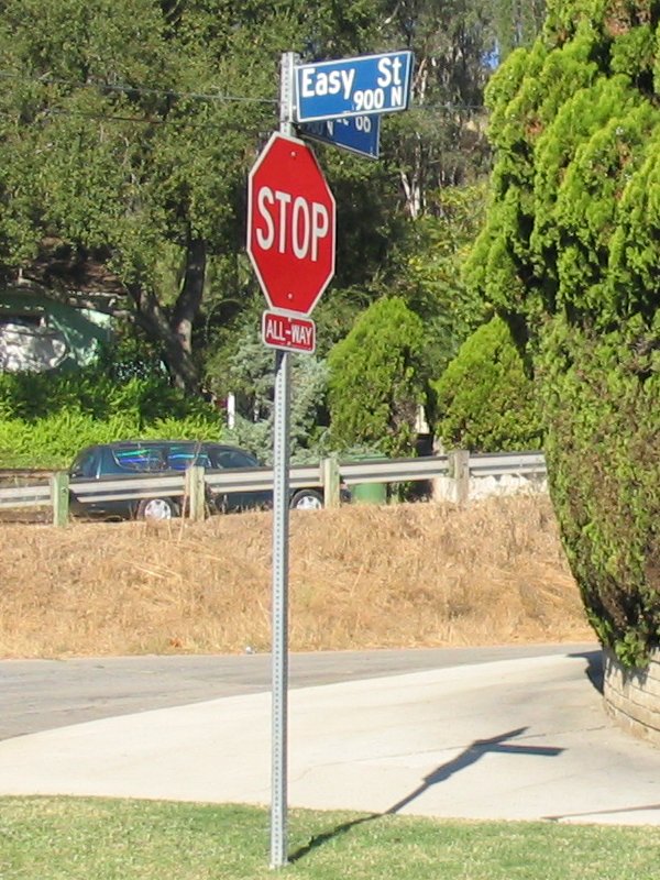
We rode down past the stables on San Pasqual and then up the west side of the arroyo. I was slightly amused when we found ourselves riding on Easy St. Then we went up Patrician Way and down Glenoaks to just above the Rose Bowl. From there, the ride went back to the park. It was still early, so I went left on Lida and rode up and over the hill there.
I finished off the ride by going back across Pasadena to home.
I’d like to say it was a nice ride, but that’s not really possible, given what happened.
39 miles.