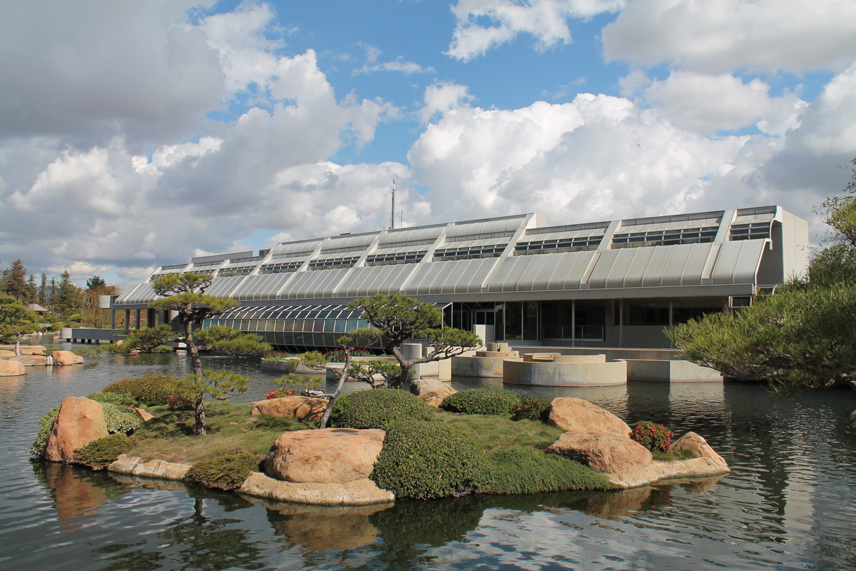
A couple days ago, I ran across this article:
http://la.curbed.com/archives/2015/03/spotlights_los_angeles_marathon_route.php
The plan was to put up 27 powerful searchlights along the Los Angeles Marathon route from Dodger Stadium to Santa Monica, and have them turned on for about 90 minutes on Friday night. Of course, in their artist’s conception, it looked pretty cool. While it remained to be seen how good it would look in person, I was curious.
I figured that any suitably high overlook would be mobbed with people trying to see, so I thought that hiking up Mt. Hollywood in Griffith Park might be a good alternative. There’s usually a small crowd up there on any normal night, but regardless, I figured the fact of having to hike several miles to get there would ‘thin the herd’ a bit. So in the end, I went there with Karina, Morgan, and Jason from my office, and we hiked up the back side of the mountain.
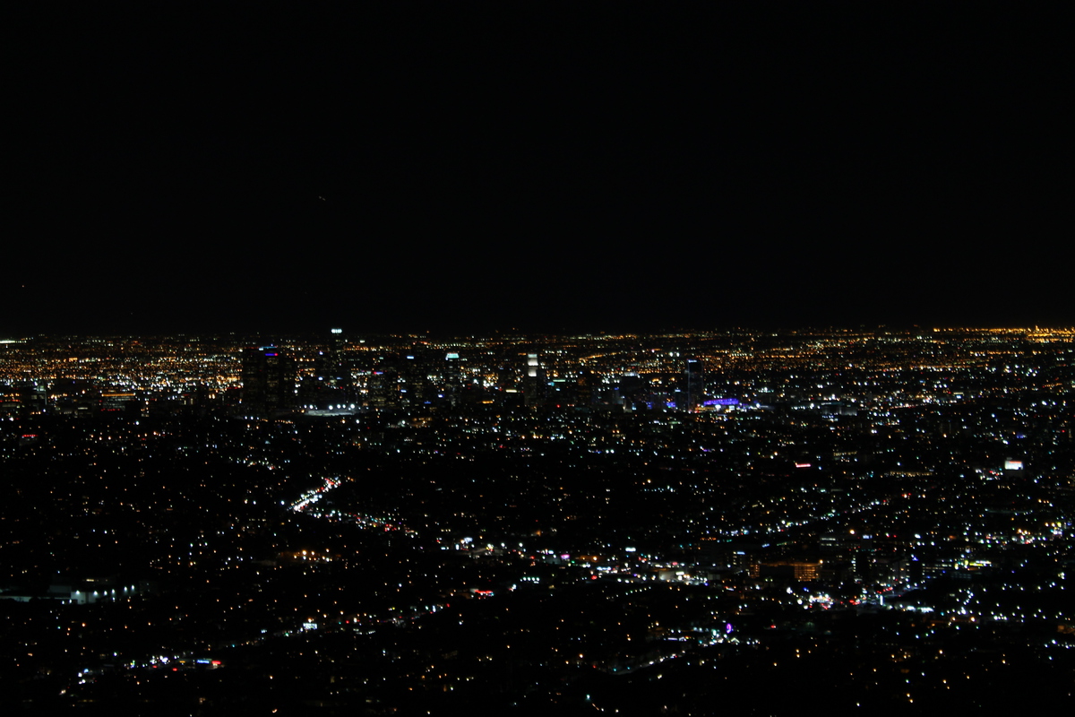
This was my first time hiking this mountain since 2011. We went by way of the ‘anklebreaker trail’. I don’t know why they call it that, since it’s not a bad trail by any means. In any event, it was a fine way to get up the mountain, and we were at the top in just about one hour. At the top, there were a lot of people. More than on a regular evening, but still nothing like the crowds that had to be down below at the observatory. Looking down, I could see the road up to the observatory, and it was packed solid with cars, and nobody was moving. So I was glad not to be there.
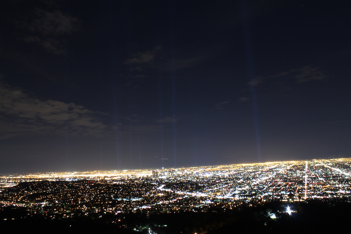
We broke out some snacks while we were waiting for the 8:40 to come around. I put my camera on the tripod and took some test photos of the city lights, just to get a feel for how different exposure times would come out. I started at 1/30 and went up to a full second, and I figured that the longer exposure would give the best results. Fortunately, between the tripod and the remote shutter release, I was able to keep the camera very still for the shots.
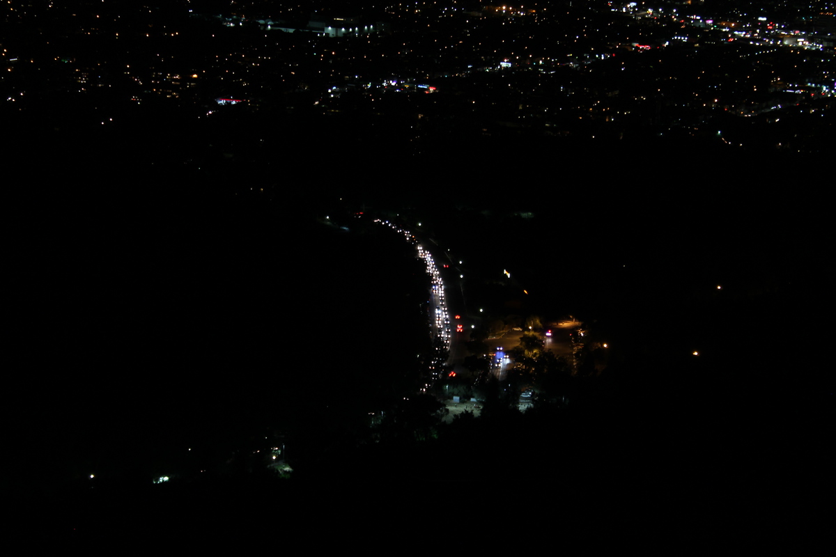
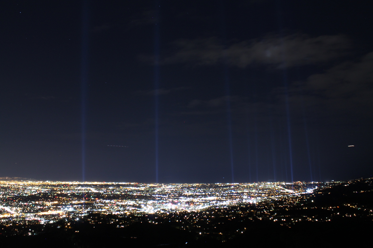
When they turned on the searchlights, it wasn’t as spectacular as the artist’s conception. If there had been more haze, it would have been better. But I started taking pictures, and with some more experimenting, I found that by pushing the exposure time up to 6-8 seconds, I could get the lights to show up pretty nicely. So I took several photos looking toward the marathon start near downtown, and several more looking toward Santa Monica.
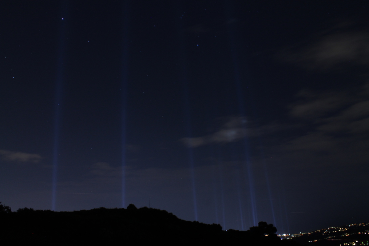
We looked at the lights for a little while before we had to head back down so we could be out of the park before the closed the gates at 10:30. On the way down, I stopped and took one more picture of the lights, this time with the mountain blocking the city lights. For that shot, I put the exposure up to 15 seconds, since I didn’t have to worry about city lights being overexposed.
On the way down, we took the fire roads most of the way. It was a little longer, but very easy to follow in the dark. And I got to try out the uber-powerful little flashlight I got last November, after Karina and I got caught in the dark on the way back from Cucamonga Peak. It worked quite well, so I was happy. This was a pretty fun little adventure.