Stan’s Obligatory Blog

10/14/2017

San Andreas Fault with Atlas Obscura

Filed under: — stan @ 7:51 pm

Today was yet another edition of the Atlas Obscura San Andreas Fault Scavenger Hunt. This is the third time I’ve been doing this tour with Atlas Obscura, and it seems to be as popular as ever. This time, my partner for leading the tour was my friend Morgan from the office.

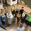
We all met at the Seismo Lab, and we started off with a quick tour of the lab. We saw the lobby exhibits about the history of earthquake study, the media center upstairs, and a small exhibit about Charles Richter and Beno Gutenberg, who started the Seismo Lab and systematic study of earthquakes back in the 1930s.

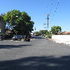
The first stop of the tour was the small fault scarp next to the McDonald’s drive-through in San Fernando. This is a small remnant from the 1971 Sylmar earthquake.

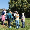
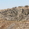
The next stop was the scenic overlook and the famous road cut along the fault in Palmdale. When we were walking up the hill to look at the road cut, we ran across a tour group of students from Long Beach State. They were apparently doing about the same tour as we were, but traveling in the opposite direction.

We stopped for lunch at Charlie Brown Farms, which is still a deeply weird place. This time, I noticed that they had camel meat in the freezer. I suppose it tastes like chicken…

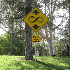
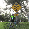
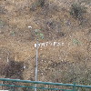
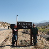
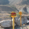
After lunch, we had a pair of stops close together. One at the signs marking the fault, and then at the Pallet Creek trench site, which was where the science of paleoseismology was born. The signs are kind of a silly stop, but it’s a chance for a photo-op. The trench site is interesting from the standpoint of it being important to the history of science.

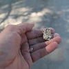
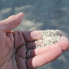
Now it was time to go into the mountains. We stopped at the road cut that has the fault gouge on one side, and we showed everyone how the rocks in the sand could be crushed by hand. That’s always popular. Then we continued on to Wrightwood.

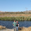
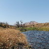
The last stop was at Lost Lake in Cajon Pass. Last year, it was suffering from three years of drought, and the lake had no water in it. But this time, it had some water, and was actually a lake.

And that was our tour.


10/1/2017

The Whittier Narrows Earthquake

Filed under: — stan @ 2:33 pm

Today is the 30th anniversary of the Whittier Narrows Earthquake. This was felt all over Los Angeles, and it caused some significant damage in nearby towns. So today’s bike club ride was to visit a few locations associated with the earthquake.

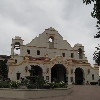
The first stop was at the San Gabriel Civic Auditorium. This building was damaged and later repaired. You can see a photo of the damage here:

http://scedc.caltech.edu/significant/whittier1987.html

We could see that the upper portion had been patched up, and there were still some cracks in the lower part of the building.

The next stop was the epicenter, which was just a few blocks southeast of the big intersection of Walnut Grove and Garvey in Rosemead. Not really much to see there, but that’s the place.

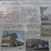
Next we rode to the Whittier Greenway Trail, where we saw a display of bricks and columns that were salvaged from a few historic buildings that were damaged enough that they had to be torn down. Then from there, we rode into downtown Whittier, and our snack stop at Mimo’s Cafe.

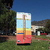
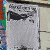
The last stop of the tour was at the Whittier Museum, which is hosting an exhibit about the earthquake. The building pictured on the banner outside was just a few blocks away.

Here are some more pictures from that day:

http://www.nbclosangeles.com/news/local/Whittier-Narrows-Earthquake-Puente-Hills-Fault-California-Seismology-Photos-Images-448452433.html

45 miles.
Route map and elevation profile

9/24/2017

East Valley Lines

Filed under: — stan @ 2:56 pm

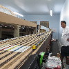
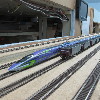
Today’s bike club ride was a visit to Travel Town in Griffith Park to see the East Valley Lines model railroad. I found out that one of my friends from the office is a member, and he was going to be running trains there today.

We took our regular route out, across Eagle Rock and Glendale, with a stop at Paradise Bakery for a chocolate eclair. Then we rode a loop out and back through Burbank before heading over to Travel Town. When we got there, Claude let us into the room with the layout. We were able to stash our bikes in the club workshop area. Then we got a good close look at the layout, which is of course under construction. We were there for about a half-hour watching the trains.

The route back took us down the L.A. River, with a quick stop at Spoke to get some ice water. Then back up the Arroyo Seco bike path to get back to Pasadena.

43 miles.
Route map and elevation profile

9/23/2017

So then this happened…

Filed under: — stan @ 9:53 pm

On Saturday the 23rd, we moved Lucinda into her new room at Porter College at UC Santa Cruz. This was exciting and sad at the same time for all of us. But the sad will pass and the exciting will take over. So here we go…

8/21/2017

The Main Event

Filed under: — stan @ 8:03 pm

So, after two volcanoes, some sloths, thousands of tiny salmon, and dinner with Aunt Karen, it was finally time for the real reason for the whole trip. The total eclipse, and we had good front-row seats in the back yard of Kathleen’s brother Johnny’s house in Salem, Oregon.

We got stupendously lucky with the weather. It was a perfect, clear blue sky when we woke up. I set up my telescope with the camera on a little portable workbench on the back patio. With the clock drive going, the telescope tracked the sun as it rose.

I snapped a few pictures of the sun through the solar filter just to see what it looked like, and to get the camera settings right. I’d used the filter before for the transit of Venus, and also a partial eclipse in 2012. But since I’d never seen a total eclipse before, I knew that I’d be guessing about the settings when that time came.

First contact was about 9:00AM or so, and it looked just like every other partial eclipse I’ve seen over the years. We just watched as the Moon slowly marched across the face of the Sun. It wasn’t until it was probably 90% covered that we could really notice that the light was getting dim, and right at the end, it got cold, too. But then, when the actual moment of totality came, it was like a switch was flipped, and I suddenly realized just why people travel all over the world to chase eclipses. It was really quite spectacular.

I pulled the filter off the telescope, and took some photos. I’d set the camera for ISO 800, and started with a guess of about 1/60 second exposure. Then I increased the exposure on each shot, just to see what it would look like. Because I’d forgotten the remote shutter-release thingy at home, I had to set the camera on a 2-second timer. That way, for each picture, I’d press the button by hand, and then the telescope and camera had two seconds to stop wiggling before the shutter tripped. For a last-minute workaround, it worked reasonably well. And besides, the enforced wait between pictures gave me some time to just look up a the sky, slack-jawed at the sight of the solar corona.

As the Sun started to reappear, I snapped a couple more pictures, and by sheer luck, I got a reasonably good picture of the ‘Diamond ring’ effect right at the end of totality. All told, it was a good time, and was easily the thing that made the whole trip worthwhile.


8/20/2017

Lava River Cave

Filed under: — stan @ 5:25 pm

Today was our last day at Newberry Volcano, and we got up early to go and see Lava River Cave before it was time to head back to Salem for the eclipse.

The cave opens at 9, and we got there a bit before that, just so we could be in the first group to go tour the cave. The rangers gave a short talk about cave safety, and then we picked up our rental lights and headed down to the entrance. Even though it’s August, the inside of the cave was an even 42 degrees, so it was actually pretty chilly.

The cave itself was pretty big. Most of it was just easy walking. There were just a few places where the roof was low, and we had to stoop a bit. The floor of the cave was covered in sand. The rangers said that the sand was actually ash from the eruption of Mt Mazama, about 7,000 years ago. That eruption left a thick layer of ash over the whole of what is now central Oregon, and the ash was washed down into the cave by rain over the years.

The walk through the cave was about a mile to get to the end. The cave went on, but the ceiling was very low, and the sign said to turn around and go back. So that was our little cave adventure, and now it was time to head back to Salem to see the eclipse.

8/19/2017

Newberry Caldera and Lava Butte

Filed under: — stan @ 8:52 pm

Today was our day to play tourist in the caldera at Newberry Volcano. We were staying in a little bed-and-breakfast place, and while we were having our breakfast, we saw couple of bucks wandering by. Then we headed over to the volcano. The first stop was at Paulina Falls. This is the western edge of the caldera, and it’s where water from Paulina Lake drains out of the crater. From there, we went to the visitor center. They had a stack of the USGS fact sheets about the volcano. I told the guys there that it was that fact sheet that got me interested to come there and see it.

Our next stop was the Big Obsidian Flow. This is one of the newest lava flows, at only about 1,300 years old. Apparently, obsidian was an ideal material for making arrowheads and other cutting tools in the ancient world. And it’s usually hard to come by. But this lava flow had lots of it. So the people who lived around here were able to collect it and trade it for other things. The signs along the trail said that arrowheads made from Newberry obsidian are found all over the western U.S.

After the obsidian trail, we went to the East Lake Resort for lunch. We also walked along the shore of the lake a bit, looking for hot springs. Apparently, the two lakes are both fed by hot springs that just sort of seep out of the lake shores.

The next stop was Lava River Cave. This is another lava tube cave. It’s open during the day, and the rangers there rent out lights to use in the cave. But when we got there, there were too many people already there, and we couldn’t get in. So instead, we went on the main visitor center at Lava Butte.

Lava Butte is a small cinder cone volcano. It formed in an eruption about 7,000 years ago. It’s also surrounded by a large lava flow that came out at around the same time. We took the short trail through the lower part of the lava flow. After that, we rode the shuttle bus up to the top of the cone. There, we walked the short trail that goes around the rim of the crater. By this time, the wind had shifted a bit, and the air wasn’t as smokey as this morning. Since we missed seeing the cave, we made plans to come back first thing in the morning to see it before heading back to Salem.


8/18/2017

Salmon and sloths

Filed under: — stan @ 9:30 pm

Today was an odd day. It was mostly traveling from Mt St Helens down to central Oregon to see Newberry Volcano. And along the way, we went to see a salmon hatchery on the Lewis River, also a sloth rescue, and we met up with my aunt Karen for dinner.

We started off at the salmon hatchery. One of the guys who worked there gave us a short tour of the facility. He said that the salmon would be returning starting in a couple weeks. At that point, the fish get diverted into the tanks there, and then they are sent into the sorting room. Wild fish are separated out and put in tanks to be taken up river in trucks. The hatchery fish are taken and ‘artificially spawned’ to create the next generation, and the fully-grown fish end up being given to food banks.

Our next stop was the sloth center in Ranier, Oregon. They took us on a short tour, and then we got to have a close-up meet-and-greet with some of the sloths. They gave us a little bowl of cucumber wedges to feed to the sloths. And they said that we could pet the sloths while they were (slowly) chewing on the cucumbers.

We had to pass through Portland, so we met up with my aunt Karen for dinner there. This was the first time I’d seen her since 1994.

The last part of the journey was up and over the mountains between Salem and Bend. We saw some nice lenticular clouds over Mt Jefferson there. After that, we descended down the eastern side of the mountains, and into a tremendous cloud of smoke from some big forest fires that were going on there. The city of Bend was completely enclosed by the smoke. We were going to be staying a bit south of there, right outside the Newberry National Volcanic Monument. I’d run across a USGS fact sheet about this volcano at my office, and it sounded like an interesting place.

8/17/2017

Visiting Mt St Helens

Filed under: — stan @ 8:51 pm

Our first destination on our trip was to go see Mt St Helens. As it turned out, we got there early enough on Wednesday afternoon to be able to go to the south side of the mountain and do a little sightseeing there. We went and saw Lava Canyon, the path of a big lahar from the 1980 eruption, and also the entrance to Ape Cave, which is a long lava tube cave. We didn’t have flashlights, so were weren’t able to go explore inside.

Lava Canyon was very pretty. It’s a steep canyon, so there were lots of waterfalls. We walked down one side of the canyon, and the crossed over on a suspension footbridge. Just like on Tom Sawyer Island at Disneyland. Except the bridge at Disneyland isn’t 100 feet above the water, and it doesn’t have a broken board right at the start to inspire confidence. This bridge kind of gave me the willies. But we made it across just fine.

The next day, we took the road up the Toutle River valley to the main Visitor Center, and to Johnston Ridge. Along the way, we saw the Bigfoot statue that was made out of cemented-together ash from the 1980 eruption. We also stopped at the Weyerhauser visitor center, where we found out that the trees they are farming there are all genetically modified to grow straighter, taller, and faster than regular trees.

At Johnston Ridge, we took in the view of the crater. We saw the trunks of trees that were blown over by the blast of the 1980 eruption. I zoomed in on the lava dome inside the crater, but I wasn’t able to see any steam coming off of it. The docents said that steam is sometimes visible when the temperature is right. We also saw a small group of elk down in the valley. One of the docents had a small telescope so we could see them, but my 300mm zoom lens just couldn’t quite bring them close enough.

After taking in the view of the crater, we went back down the road to the Hummocks. There is a trail through this little bit of terrain so that we can see the little hills and valleys that were created by the front end of the big landslide that began the 1980 eruption. The trail was a bit over two miles, and it went up and down and around, with signs along the way explaining how the terrain there was basically created in an instant.

On the way back, we stopped for a moment to again marvel at the GMO-forest. The trees are all so identical that looking at them made us feel like our eyes were going blurry, even when they were perfectly focused. It was impressive in a weird way.

Route map of the Hummocks Trail

8/13/2017

Pan Pacific Park

Filed under: — stan @ 2:05 pm

Today’s bike ride was a visit to Pan Pacific Park in Los Angeles. This was the site of the Pan Pacific Auditorium, which burned down in a spectacular fashion in 1989. After the fire, the burned-out hulks of the streamline-moderne entrance stood in the park for several years, before being torn down. Now, there is a new recreation center there, and its design echos the entryways of the old structure.

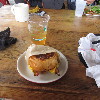
Our snack stop was at a new place. Just by chance, I found reviews in Yelp about Jessica Cafe inside of Park La Brea. We asked the guard at the gate, and she told us how to find it. They had pretty good food, and a nice outdoor area to sit. So it was nice.

46 miles.
Route map and elevation profile


Powered by WordPress