Stan’s Obligatory Blog

Page 22 of 35« First...10«2021222324»30...Last »

8/16/2015

Spoke

Filed under: — stan @ 10:53 pm

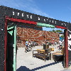
Today’s bike club ride was a visit to Spoke Bicycle Cafe, on the L.A. River in Frogtown. We’ve been down that way before to visit The Frog Spot last summer.

We started out from Victory Park and headed west. And we didn’t get too far before GT got a flat right in front of the Gamble House. (The Gamble House is a landmark in Pasadena, and it also was Doc Brown’s house in 1955 in the “Back to the Future” movies)

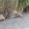
We rode across Eagle Rock and Glendale all the way into Burbank. Then we turned west to go on the Chandler Bikeway. We took a short side trip to see the desert tortoises along the way. Then we headed south to pick up the L.A. River bike trail, which took us all the way to Frogtown and Spoke.

It was pretty hot today, and we pretty much all wanted cold drinks and maybe some small snacks. But Spoke was nice. It was a good place to stop along the river trail, and I think we’ll go back there again. I got a big iced tea, and after I finished that, they gave me another cup of ice to put in my water bottle for the ride back to Pasadena.

We started out up Figueroa, and then turned off at Avenue 43 to get on the Arroyo Seco bike trail. We’ve been on part of that before, but this was the first time we rode the entire length of it. And it was pretty nice. At the end, it let us out into South Pasadena, and at that point, our group kind of broke up. It was very hot, and everyone just wanted to head for home, and only a few of us live near the park where we start. So in the end, it was just a few of us who went all the way back to Victory Park. But it was a nice ride.

43 miles.

Route map and elevation profile

8/9/2015

Checking in with the Big Donut

Filed under: — stan @ 2:30 pm

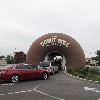
This Sunday’s bike club ride was a visit to the Donut Hole in La Puente. Along with the Idle Hour cafe, the giant tamale, and other odd sights we’ve gone to see over the years, it’s a prime example of programmatic architecture. And we haven’t been to see the donut in a while.

On the way there, we stopped by the new Metro Rail station under construction in Arcadia. It looks like it’s almost done, and they’re having an official dedication for it in two weeks. A little farther south, we noticed one intersection that had big, round skid marks right in the middle. Apparently, we were not the only ones thinking of big donuts recently. We went by the replica of the original In-N-Out Burger in Baldwin Park. And then we got to the big donut. There was a line of cars back out to the street. This is they busiest we’ve ever seen them on a Sunday morning. Maybe this means the economy is picking up or something. It’s never been that busy when we visited before.

Continuing on, we made a big loop through West Covina and back to Irwindale. We passed the Huy Fong Foods hot sauce factory there. We rode into Santa Fe Dam and up the bike path to Duarte, and then back on Royal Oaks to Monrovia. We found Merengue, and it has finally reopened in their new location. The last time we looked in on them, they weren’t quite ready to open yet. I got an empanada, Carla got a Refugee, and all was right with the world.

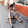
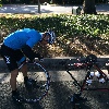
When we got ready to leave Merengue, I discovered that I’d gotten a flat. It’s been a while since I got into the Flat Tire Gallery.

Even with the flat tire, it was a good ride.

43 miles.

Route map and elevation profile

7/26/2015

Taco Bell

Filed under: — stan @ 1:53 pm

I recently read that the building that was the world’s first Taco Bell is going to probably be torn down soon. I looked it up, and it’s in Downey, not far from the old Johnie’s Broiler that we visited recently. Between that and the oldest operating McDonald’s in Downey, there’s a lot of fast-food history there.

We rode straight down Del Mar through San Gabriel, and then when we got to Whittier Narrows, we turned down Rosemead and took that all the way to Downey. We passed the old McDonald’s and then turned on 5th St. That took us past the apartment buildings The Carpenters owned. Then, when we got to downtown Downey, we stopped for coffee and snacks at 3rd St Coffee.

After the snack stop, we continued west for a bit, and then south to Firestone Blvd. We went a couple of streets beyond Firestone, turned right, and came back out on Firestone through a sidewalk at the end of a cul-de-sac. That brought us out right by the former Taco Bell. The building, as well as the building next to it, and their parking lot were all fenced off. I had to hold the camera up over the fence to see anything. It looks like the preservationists may not have succeeded, since the site looked like it was ready to knock down. I guess we will have to stop by again in the future and see.

Continuing south for a bit, we came out by the Rio Hondo. We got on the Rio Hondo bike trail and took that all the way back to Whittier Narrows. Then we took Walnut Grove back home. It was a pleasant ride.

40 miles.

Route map and elevation profile

7/12/2015

The Rock Walk

Filed under: — stan @ 1:28 pm

A few years ago, I took a ride to Hollywood to do a Ramones tour. One of the stops on that tour was at Guitar Center on Sunset to see the Ramones’ handprints in the concrete in front of the store. I recently realized that the Rock Walk has a lot more than just the Ramones on it. In particular, I saw that the Funk Brothers are on it. So I thought this would be a good piece of sightseeing for the Sunday morning bike club ride.

We rode out there by our regular route through South Pasadena and Highland Park. After we crossed the L.A. River, we made a quick stop to see the Snow White Cottages. We’ve been by there a hundred times, but never made the half-block side trip to see them.

Once we got into Hollywood, we rode the length of Hollywood Boulevard down to the Chinese Theater. Then we turned off and headed down to Sunset and Guitar Center. Sadly, Guitar Center doesn’t open until 11 on Sundays, so we could only look at the handprints through the screen that they close at night. Still, it’s quite a collection.

From there, we rode down to Larchmont Village to Noah’s Bagels. I took a walk a couple doors down the street to Salt and Straw just to see what they had there. It looked and smelled good, but 10AM is just a little early for ice cream for me.

The route home was our regular route up Benton Way through Silver Lake. I’d read recently that they were draining the Silver Lake reservoir, but when we went by it, it still had quite a bit of water in it.

At the end, we went through Eagle Rock and up the Colorado hill to get back to Pasadena. It was a nice ride.

40 miles.

Route map and elevation profile

7/5/2015

Glendora Mountain for the 4th

Filed under: — stan @ 2:59 pm

It’s July 4th weekend, and once again, they closed Glendora Mountain Road to cars. So, like we have for the past several years, the Sunday Morning Ride went there to enjoy riding the quiet eight-mile climb up Glendora Mountain.

The ride out there was pretty routine. And when we got to the turnoff, we rode the mile or so up to the closed gate, lifted our bikes over, and headed up the mountain. Along the way, we passed some guys hiking up with their skateboards. And then, a little farther up, we were passed by three guys on skateboards who were coming down the mountain fast. We also saw many, many other bike riders who had the same idea we had and had come to ride the fabled mountain road.

It was cool and overcast, which made for a pleasant ride. Up near the top, we came out above the marine layer, and we had blue sky and sunshine for the last mile or two of the climb. Still, it was a far cry from the time we rode there when it was over 100 degrees. And four years later, we still talk about how good the oranges we had that day were. But today was basically a perfect day for riding.

I’d brought along my little GPS unit, so I finally know just how long that hill is. According to the data, it’s about nine miles and 2,400 vertical feet from the turnoff at the bottom to the top of the hill. That works out to about a 6% grade, which is pretty consistent all the way up.

On the way back, we were going to try to go to Merengue in Monrovia. I’d read that they had a new location, and we were able to find it, but it wasn’t open. They had a sign in the window saying that they were going to be conducting interviews this coming week to hire staff to run the place, so that implies that they will be open again soon. In the meantime, we went up to the Coffee Bean at Foothill Blvd and had snacks there. Then we headed home by the most direct route. That was where Jim got a flat. But despite that, it was a pleasant ride.

55 miles.

Route map and elevation profile

7/2/2015

The Griffith Park Tea House

Filed under: — stan @ 7:17 pm

Yesterday, I read about how some unknown artists had popped up a little Japanese-style tea house on an old concrete pad on top of one of the peaks in Griffith Park. Apparently, it was done on the sly in one night, and from the pictures I saw, it looked like it was very nicely done. Since it was unclear how long it would be there, I figured it was something we should go see immediately. Fortunately, Morgan and Jason from my office were up for it, and we headed over there this afternoon.

The instructions on how to find it from Modern Hiker were for starting out from the observatory, but parking there is always a problem, and coming from Pasadena, it’s just easier to start from the other side of the park, by the Old Zoo. We headed up the trail just like we did back in March, when we went to Mt Hollywood to see the marathon lights. When we got to the part of the trail that goes around just below Taco Peak, we looked up, and the tea house was there. Just a short distance up the trail, we came to the spot and saw it close up. There were quite a few people there to see it. I guess everyone had the same reaction to hearing about it.

The artists had left pencils and little wooden chips to write wishes for Los Angeles on, but all the wood chips had been used. We went inside to see them all hung on the pegs and read what people had written. It was all very nicely done. The construction of the house was first-rate, and it really looked like it belonged there. It’s unclear what will happen to it, but at least we got to see it when it was still fresh.

It kind of reminded me of Amir’s Garden, which is another place in the park that was built by one man with a vision. So on the way down, we took a route to go through there. It was nicely cool and shady there, as the garden is irrigated with what I can only assume is reclaimed water. But it was very nice there. Then we took a very steep trail down the end of the ridge to get back to the trail that would bring us back to our starting point. It was a good little afternoon adventure.

Route map and elevation profile

6/21/2015

“Can we all get along”

Filed under: — stan @ 5:39 pm

Whenever police misconduct is in the news, the story of Rodney King comes up. He was really the first high-profile case of the modern era where police doing bad things were caught on video. At the time, that was a first, but now, we’re seeing it over and over, and it’s shining a light on something that the police really don’t want people to see. Because of that, and the L.A. riots in 1992, Rodney King became an icon. I’m sure he never wanted to be a household name. After that, he lived his life in a fishbowl, which must have been very unpleasant. Still, the ordeal he went through led to some positive changes for society.

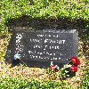
I recently found out that, after several years of being unmarked, Rodney King has a proper headstone. So today’s ride was to go see it, and to remember the reluctant icon.

It was a good day for riding, and we had a pretty big group this time. Apparently, Father’s Day is a big occasion at Forest Lawn, and the place was packed. When we got there, we rode all the way to the back. It’s about a mile from the front gate to the back section where Rodney King is buried. His new marker is nice, and it’s kind of fitting that it features the one line he’s remembered for. In all his time in the media spotlight, he never said much. Maybe he didn’t want to say anything, and maybe nobody ever asked him what he thought. But there is still the one line he is remembered for, and apparently, most people remember it wrong. I looked up on Youtube and found the video clip, and he did in fact say, “Can we all get along”. So there it is. Like the headline on an obituary, to have one’s entire life summed up in one line.

Continuing on, we stopped for snacks at Priscilla’s. Then we headed home, across Glendale. GT’s friend Lura got a flat, so I doubled back for a quick picture for the Flat Tire Gallery. Then we rode up Verdugo and home through La Cañada. It was a nice ride.

45 miles.
Route map and elevation profile

6/7/2015

Burger Tourism

Filed under: — stan @ 1:54 pm

Last fall, we rode out to Baldwin Park to see the replica of the original In-N-Out Burger stand that they built down the street from their In-N-Out University and company store. This past week, I realized that if we did that same route in the other direction, we’d get to the In-N-Out museum right around 11:00, and it’s open from 11-2 Thursdays through Sundays.

We started out from Victory Park and headed east. We rode through Monrovia and Duarte to get on the San Gabriel River bike path. We took that to Irwindale, where we rode past the Huy Fong Foods sriracha hot sauce factory, and then south into West Covina.

We stopped for snacks and such at Panera in West Covina. Then we continued south to La Puente, making a big loop that brought us back to Baldwin Park. Unfortunately, our timing was a little off, and we got to In-N-Out at 10:45. Since we had a few minutes to wait, and it was pretty hot by then, I went and rode through the regular In-N-Out drive-through and got some iced tea. The drive-through is a big part of the total In-N-Out experience, and just because I was on a bike wasn’t going to stop me from experiencing it.

By then, it was 11:00, so we rode back under the freeway to the In-N-Out museum. Karen was our docent, as it were. She said that she is a regular In-N-Out crew member, but she spends three hours of her shift working at the replica of the original stand, greeting visitors, answering questions, and generally telling the story of how In-N-Out got started. She took our picture in the drive-through at the replica, and she showed us the washing machine that they used in the old days to wash and spin-dry the french fries before they cooked them. She also showed us a picture of the guy whose job it was to sit out back and peel potatoes by hand. After the potatoes were peeled, they cut them into fries by hand with the same machines they use today. It was all an interesting piece of history.

The ride home from Baldwin Park was mostly uphill, but not unpleasant. It was a warm day, and summer is definitely on its way.

43 miles.
Route map and elevation profile

5/31/2015

Ciclavia Pasadena

Filed under: — stan @ 1:41 pm

Today was the day that they had the first Ciclavia in Pasadena. We occasionally go to these on the Sunday morning bike ride, and since it’s right here, I figured we could go to it on the way home today. Our route was the old Mt Washington ride, just modified to come back by way of Old Town Pasadena to pick up the Ciclavia route. And as a special treat, I’d gotten a message that my old bike friend from college was going to be there. I haven’t seen Aaron since I graduated in 1982.

It was a perfect day for riding. We started out by heading up to La Cañada, and then down Hospital Hill and the long downhill through Glendale. It’s pretty amazing when you think about it. It’s something like eight miles downhill and about 1,000 vertical feel. When we got down to Cypress Park and the L.A. River, we turned north and then took the short side trip up and over Mt Washington. Then we continued on through Highland Park and South Pasadena to get back to Pasadena and the start of the Ciclavia route.

I found Aaron and Sharon by a little bakery near Lake Avenue. It’s hard to believe that 33 years have gone by. But I’d like to think that we’re both holding up pretty well for being in our 50s.

It was a nice ride, and it was good to see Aaron again.

33 miles.
Route map and elevation profile

5/24/2015

Eleven

Filed under: — stan @ 5:51 pm

Last September, I saw an article that Mel Brooks had put his hand prints in concrete for the Chinese Theater in Hollywood. We took a ride out there to see, but when we got there, they said that the concrete blocks are kept inside for a few months to harden properly before they are put outside. So this week, I’d emailed the manager of the Chinese Theater, and he said that Mel Brooks was now out on the Forecourt of the Stars. So this Sunday’s ride was another visit to Hollywood.

We rode out by our usual route across Eagle Rock, across the L.A. River, and then through Silver Lake into Hollywood. When we got there, I saw that the dinosaur on the roof of the Ripley’s Odditorium was dressed up for summer tourist season. Then we got to the Chinese Theater and had a look around. I noticed for the first time that the block with the “Harry Potter” series cast had their wand-prints in the concrete. Then I found Mel Brooks. His block is toward the back on the east end. I tried out the six-fingered hand print for size.

Leaving the Chinese Theater, we headed up Outpost Dr. About halfway up, we saw some skid marks, a broken wall, and the bumper of a car. But the license plate was not attached to it. I guess whoever it belonged to had enough presence of mind to take the plate before running away.

At the top of the hill, we paused for a few minutes before heading down Mulholland Dr into Cahuenga Pass. We stopped for a few minutes at the Hollywood Bowl overlook. I thought it was funny that the little coin-operated telescope at the overlook had an ad on it to try and recruit more people for the coin-operated telescope business. It’s not like coin-operated telescopes are Amway or anything… Then we rode down the hill into Burbank, and our snack stop at Priscilla’s.

Heading home, we rode back across Glendale, and then up Chevy Chase and Linda Vista, coming down the other side by the Rose Bowl. It was a nice ride.

39 miles.
Route map and elevation information

Page 22 of 35« First...10«2021222324»30...Last »

Powered by WordPress