Turnbull Canyon both ways
 |
 |
 |
 |
 |
 |
 |
 |
Today’s ride was down to Whittier and then over Turnbull Canyon both ways. We were able to fully appreciate the climb in both directions.
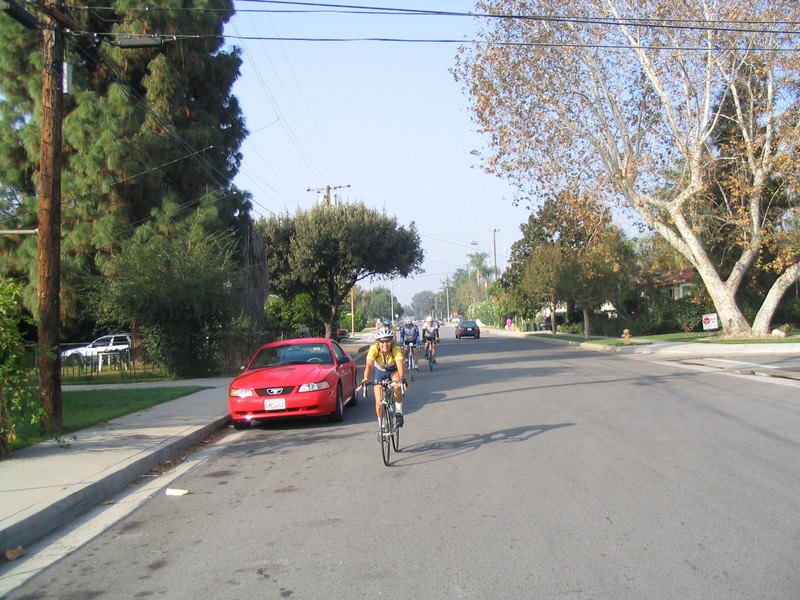
I started out meeting Gene at Victory Park in Pasadena. We rode down to Temple City to Live Oak Park to meet the rest of the group. Starting out from Live Oak Park, we rode over to the Rio Hondo bike path, and then went south to San Gabriel Blvd, just above Whittier Narrows.
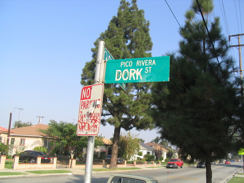
Getting on the San Gabriel River bike path, we went south some more to Pico Rivera. There we got off the bike path and took a small detour to Dork St. After that, we went west on Beverly Blvd to see the bridge over Rio Hondo that had caught fire earlier this week. Crews were busy tearing the bridge down in preparation for fixing it. We all found it amazing that a bridge for a major road was built of wood in this day and age.
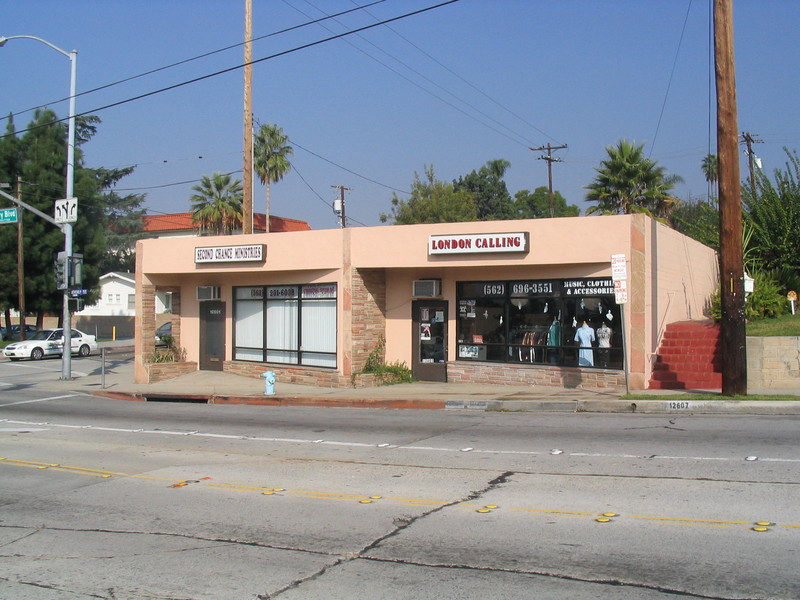
Turning around, we headed east on Beverly Blvd into Whittier. We passed London Calling, which looked like a punk rock outfitter and seemed especially out of place in suburban Whittier.
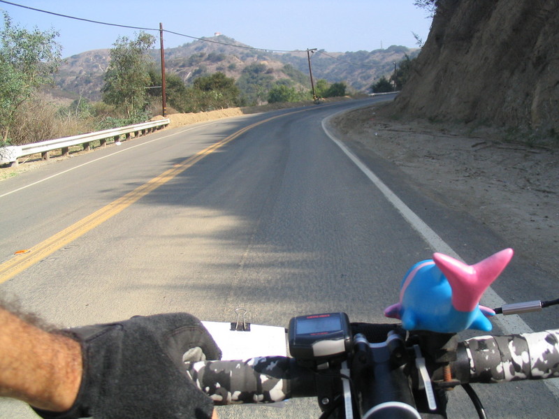
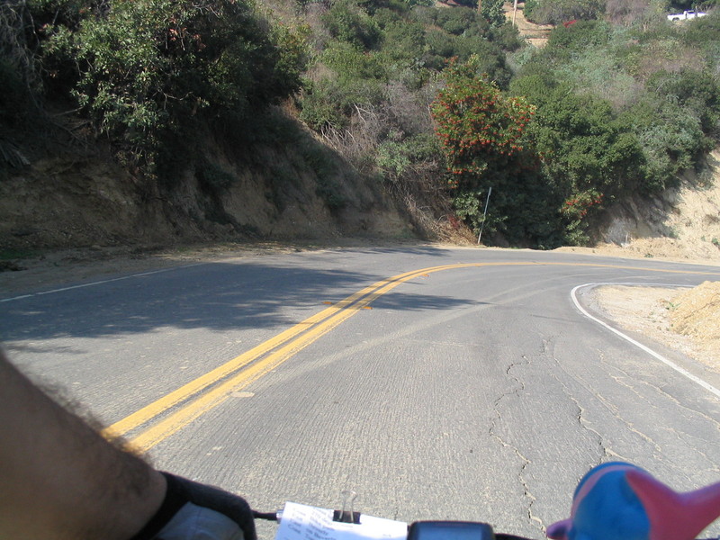
Soon, the road turned up Turnbull Canyon and we started climbing in earnest. We saw lots of mountain bike riders on the fire roads in the canyon. At the top we stopped to regroup and take in the view.
Continuing down the other side, the road felt a lot like riding a steel roller coaster. It felt at times like the road was just suspended in the air, with sheer drops on both sides.
At the bottom, we took Los Altos and Vallecito to Camino del Sur and Colima Road. Our official snack stop was at McDonald’s at Colima and Hacienda. Most of us chose not actually eat anything there. I decided to tempt fate and have an Egg McMuffin. I thought about my old riding friend Tim who used to like to eat one of these in the middle of a 50-mile ride.
After that, we continued a bit on Colima and then took Stimson, Halliburton, Newton, and Joan streets to make a loop and get back to Turnbull Canyon Road. Then we started back up.
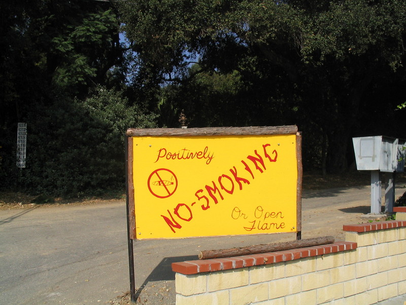
At the fire station there we saw a sign that said “Positively NO SMOKING” with a picture of a joint. I thought it was a bit funny that they would be so specific about it.
Near the stop, I stopped to pick up a flyer for a house for sale. The asking price was a cool $1.3 million. We stopped for one more regroup at the top. While we were waiting, I rode about halfway back down the hill to pick up the stragglers and then rode back up again. Remember, I like riding up hills. After everyone was at the top, we headed back down the west side of the hill.
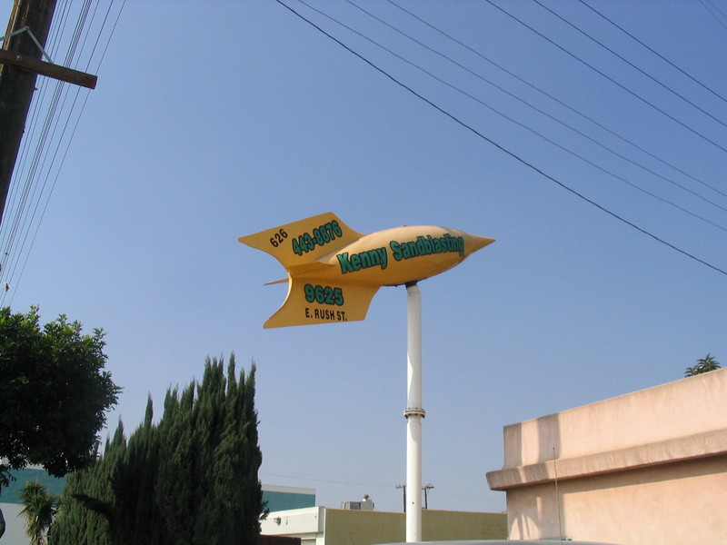
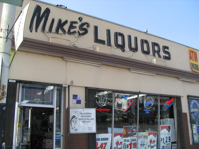
At the bottom, we took Beverly to Workman Mill. At Peck we took a left and took that up to Rush St. That was where we passed through the sheet-metal-shop ghetto and saw the rocket sign at Kenny’s Sandblasting. We also saw Mike’s Liquors and Bait Shop, which seemed a bit out of place given that Southern California is not usually renowned for its fishing opportunities.
Getting back on the Rio Hondo bike path, we went back the way we came. Then we took El Monte Ave and its enormous bike lane up to Duarte Rd in Arcadia. At Holly we took a right to get up to Huntington and took that back to Sunset.
Turning north on Madre St we crossed back into Pasadena and took some small streets back to Sierra Madre Blvd and Victory Park.
62 miles


November 5th, 2005 at 11:17 pm
love the map! Thanks