Another great Google Maps application
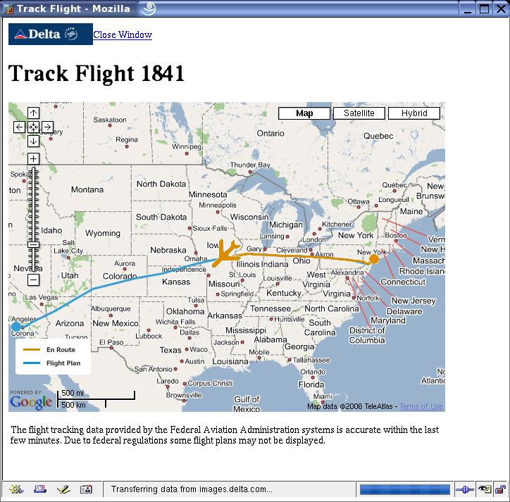
Cathy is on her way home today, and I went to the Delta Airlines web site to check the status on her flight. I was able to find it by putting in the start and end points, and then it offered a link that said “Track it”. So I clicked, and it brought up this neat little Google map showing where the airplane was, updated every few minutes.
You can zoom in on the track. It appears that the plane must report lat/lon points about once or twice a minute. The blue line shows the flight plan track, and the yellow is the actual path. If you zoom in enough, the actual path seems to wiggle along, which must be some sort of artifact of the data, since airliners tend to go pretty much in straight lines.
Of course, maybe they’ve had this on the web site for years. We don’t travel much, so I never looked at it before…


November 14th, 2006 at 4:19 pm
Hmmm…I never noticed that feature either, but sounds kool. Will have to check next time I have the flight information for charlie’s travel.
🙂
November 15th, 2006 at 8:30 pm
That is fuckin’ awesome!! If I had wireless on the plane, I would be tracking myself…