Crouching Tiger, Hidden Oil Well
 |
 |
 |
 |
 |
 |
 |
 |
 |
 |
 |
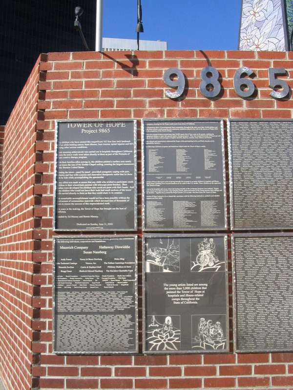
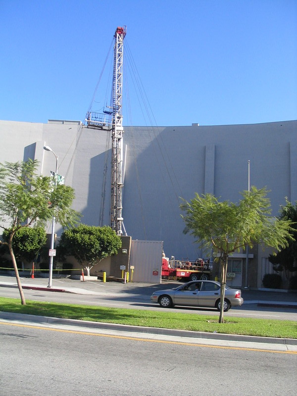
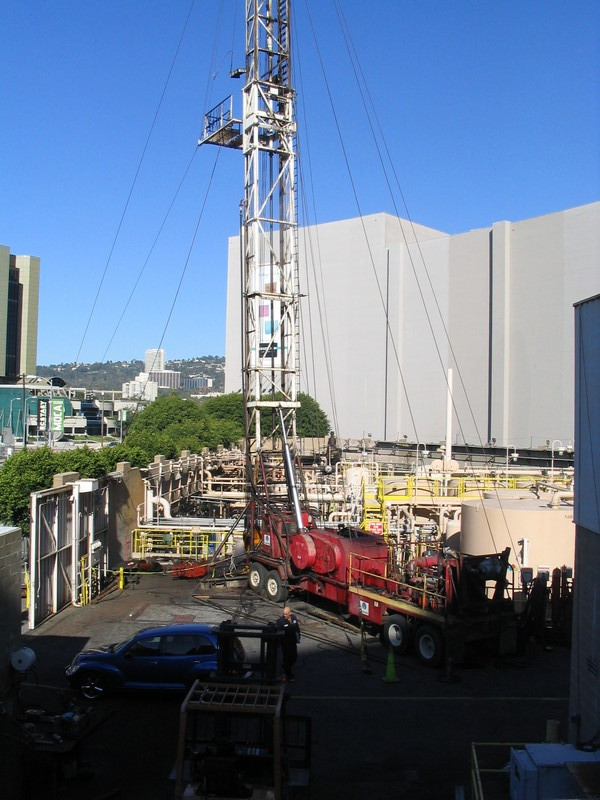
Today’s ride was a tour of the west Los Angeles oil patch. It’s a little-known fact that most of Los Angeles from downtown out to Century City lies on top of an oil field. In the 1920s, the area near the La Brea Tar Pits was a forest of oil derricks. But years ago, the Los Angeles city council mandated that oil wells in the city have to be hidden. So they are disguised behind walls and inside fake buildings. And today Gene and I went to see just a few of them.
Starting at Victory Park in Pasadena, we rode down Sierra Madre Blvd to Huntington Drive. Then we turned right and headed towards downtown L.A. We turned on Mission and then on North Main St to get into downtown proper. Then we took Spring St past the homeless camp and City Hall down to Olympic Blvd.
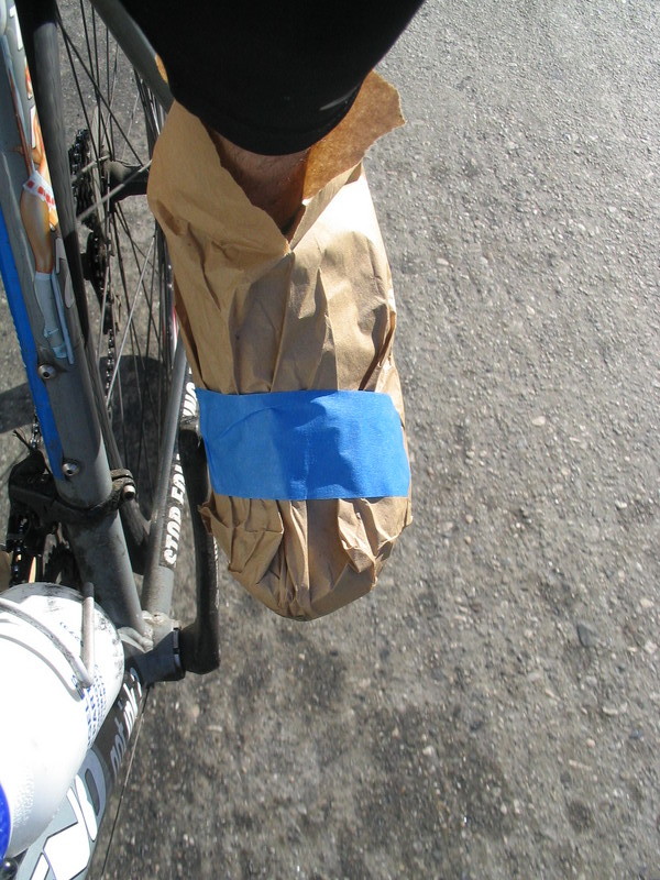
It was a chilly morning, and I had suited up appropriately, even to the point of putting paper bags over my shoes. Who needs high-priced cycling-shoe-covers when a paper bag can do the trick? Besides, we can send pictures to the Weekly World News and tell them that we’ve found “Bagfoot”.
Turning right on Olympic, we headed out of downtown and into Koreatown. This is one of the special things about L.A. We can feel like world travelers, even on a simple bike ride. One shopping center had signs almost exclusively in Korean. The only exception was a big sign for “Porno Mania”. I tried to take a picture, but sadly, the lighting was wrong and we were too far away.
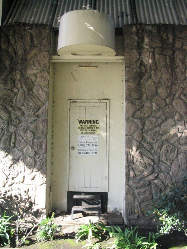
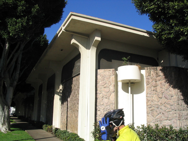
We took Olympic all the way out to just past Doheny, where we turned south to Pico Blvd and our first sightseeing stop. It was a pair of fake buildings, one which looked like a church, and the other that looked like a bank. But neither one had signs or a front door. There was just a small sign for Breitburn Energy on the side doors, some mechanical noises, and the smell of petroleum.
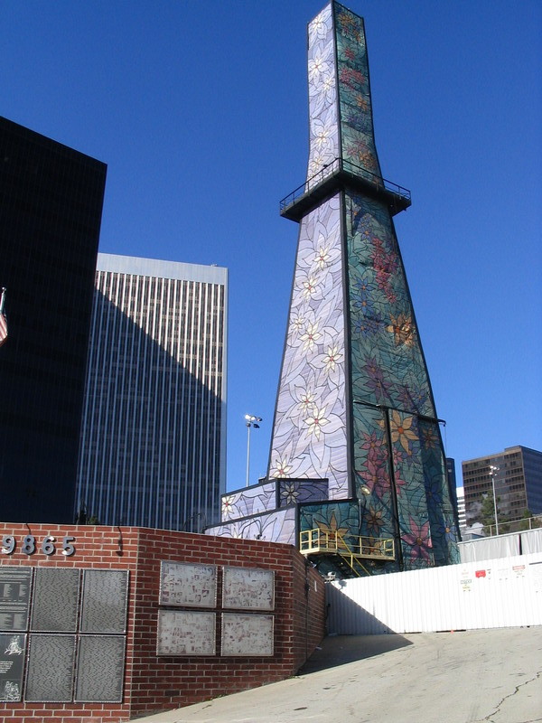
Heading back up to Olympic, we entered Beverly Hills. And at the edge of town we came to the second oil well. This one is inside a decorated tower just behind the playing field at Beverly Hills High School. The tower used to be just plain gray, but it’s been painted with flowers now.
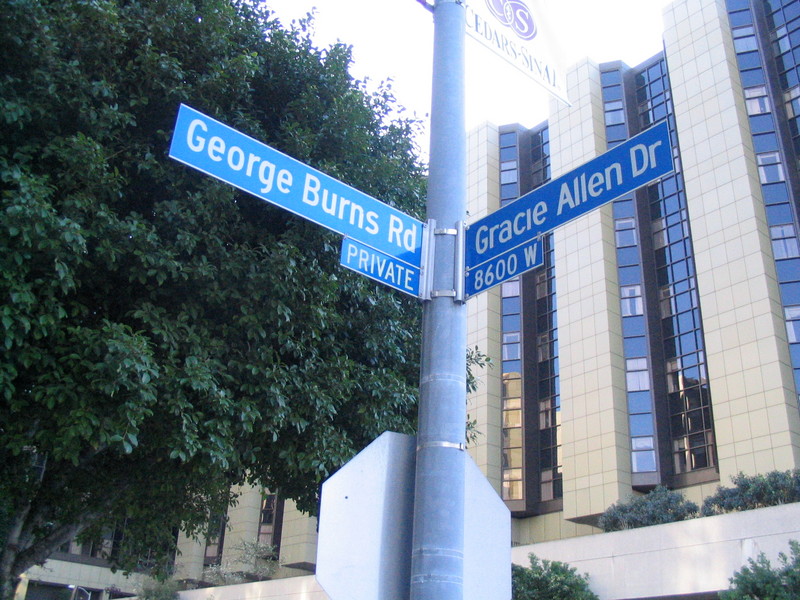
From there, we went north on Spaulding to Charleville, and then east a bit to Crescent, which we took north past Wilshire to Foothill Rd and Burton Way. We took a left on Robertson and then a right on Alden to get to Cedars Sinai Hospital. That was where we saw the intersection of George Burns Rd and Gracie Allen Way.
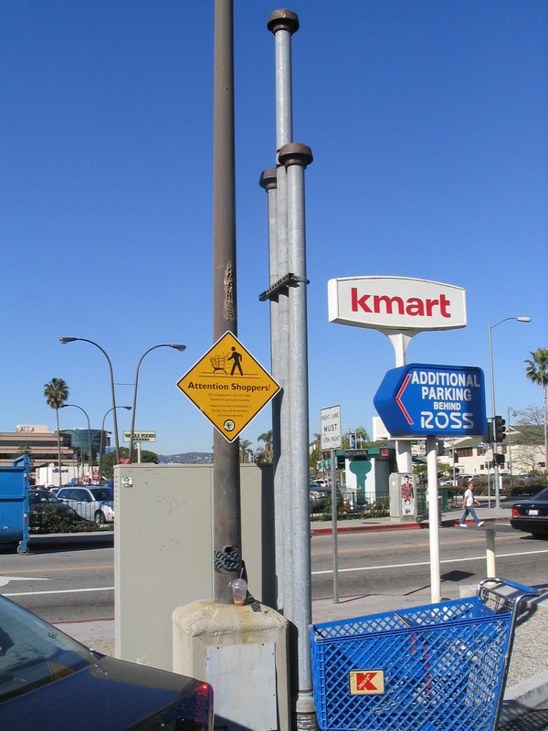
Next, we stopped at the Beverly Center mall, between La Cienega and San Vicente. There is an oil field there, in a little crescent-shaped patch of land between the mall and San Vicente. It’s behind a wall, and we had to go up the parking garage ramp on the mall to see inside.
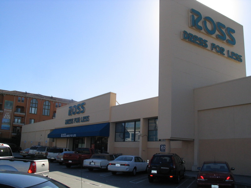
A left on 3rd St got us heading east again. At Fairfax, we stopped at the Ross Dress For Less store. This is the store that exploded back in 1985. Methane gas from the oil field had seeped up into the store. The explosion blew out the windows and for a time there were flaming cracks in the parking lot. Now the store has been repaired, and there is a vent pipe in the parking lot to safely release the methane.
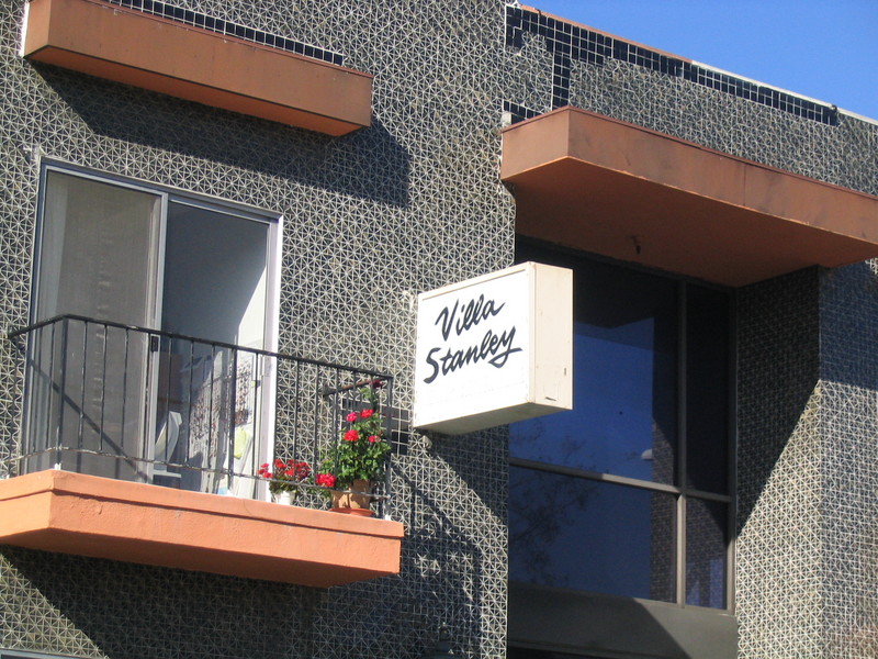
We turned left on Stanley Ave and headed up into Hollywood. I stopped for a photo-op at the Villa Stanley retirement home. I always take pictures of things that have my name on them. Then we crossed over Melrose Ave and then went west two blocks to get to Genesee Ave, which we took north some more.
At Santa Monica Blvd, we stopped to look at the “Porn Walk of Fame” in front of the former Pussycat Theater. We saw the hand and foot prints of Harry Reems, Georgina Spelvin, John Holmes, and Marilyn Chambers. I took pictures and put them in my Random Photos Gallery. Then we continued on up Genesee to Hollywood Blvd.
Crossing Hollywood Blvd, we went up Nichols Canyon Road, and it was suddenly much quieter. This is one of my favorite roads up the Hollywood Hills, and it was also recently repaved, so it was a very nice climb all the way up to Woodrow Wilson Drive and Mulholland Highway.
Turning right on Mulholland, we rode down into Cahuenga Pass, stopping briefly for water at the Hollywood Bowl overlook. Then we turned on the bridge over the freeway and got on Cahuenga Blvd for one short block. Then we turned off onto some small residential streets to get around the hill and come out on Barham Blvd.
From there, we went down the hill into Burbank and turned on Forest Lawn Drive to get to Griffith Park. Then we took Zoo Drive past the Live Steamers and Travel Town to Riverside Drive.
From there, it was the standard route home across Glendale, Eagle Rock, and Pasadena.
56 miles.

